DDiscover AloneMapAbout

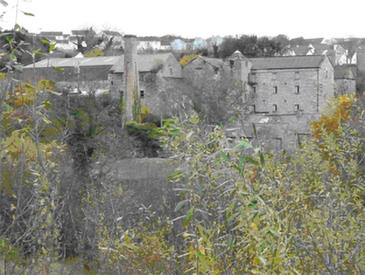
Gulladoo Mill

Mill (water)
Gulladoo Mill
Photo: National Inventory of Architectural Heritage · Report the wrong picture

This does not grant access. Most recorded buildings are privately owned; view them only from public ground unless the owner allows entry.

Recorded change of use
Originally mill (water); recorded by the architectural inventory as factory
What do you know about this place?Tap to add a comment or ask a question

What you write will be public.

What is recorded here

Attached multiple-bay two-, three- and four-storey former corn mill complex on irregular-plan, built c. 1811 and 1840 and extended c. 1880. Now in multiple industrial uses. Hipped and pitched slate roofs with stone eaves courses to some blocks, and with surviving sections of cast-iron rainwater goods. Replacement…

Read the whole record
Attached multiple-bay two-, three- and four-storey former corn mill complex on irregular-plan, built c. 1811 and 1840 and extended c. 1880. Now in multiple industrial uses. Hipped and pitched slate roofs with stone eaves courses to some blocks, and with surviving sections of cast-iron rainwater goods. Replacement corrugated asbestos cement roof to some sections. Rubble stone walls. Square-headed window and door openings with roughly squared rubble stone voussoirs, some surviving stone sills, and with remains of timber fittings. Wrought-iron security bars to ground floor openings to some blocks. Detached single-storey buildings to the south having pitched natural slate roofs, rubble stone walls, and square-headed window and door openings. Red brick chimneystack (on square-plan) to the west of site, added c. 1900. Detached two-bay single-storey lodge\office to the east, built c. 1947, having flat-roof, rendered walls, square-headed window and door openings, recessed porch to the west end supported on rubble stone-clad pillar, and projecting tapering rubble stone clad chimneybreast and chimneystack to the east end. Altered two-storey former corn mill (on L-shaped plan) to the south-east, built c. 1810 and extended c. 1850. Located adjacent to the east of the Bredagh River, and to the north-west of the centre of Moville.
This imposing and complex former corn mill complex is a significant element of the industrial heritage of County Donegal. It is one of the largest surviving early industrial complexes on the Inishowen Peninsula, and it provides an interesting historical insight into past industrial processes. It was probably originally built here to avail of the transport links provided by the nearby port at Moville, as well as to avail of the power source available from the Bredagh River. It is well-built using squared rubble stone masonry, and it dominates the landscape to the north-west of the centre of Moville. Its continued survival and use is testament to the quality of its original construction. It was originally built c. 1840 as a corn mill but was extended on at least one occasion during the second half of the nineteenth-century. It appears to incorporate an earlier mill with a datestone of 1811. It was possibly in the ownership of Edward McDowell, who owned a mill on Malin Road milling Indian corn and oat meal in 1881, and who later ran a flax and grain merchants, and a coal and timber merchants, in 1894 (both Slater’s Directory). Although this complex is in various uses, it remains an important element of the industrial and economic history of the local area, and creates historic incident to the north-west of the centre of Moville. The single-storey building to the south-west and the tall imposing red brick chimneystack, a local landmark, add to the setting and context. This chimneystack was probably built c. 1900 and was more than likely associated with a turbine to site that was also used to produce electricity for Moville c. 1925. The simple single-storey flat-roof lodge\office building to the site entrance to the east is notable as one of the first commercial commissions by the celebrated local architect Liam McCormick 1916 - 1996), often considered as the father of modern Irish church architecture. To the south-east of this complex is an altered earlier two-storey mill building that was constructed in 1810 or 1812, attesting to a long-standing industrial presence on this site that probably dates back many centuries.

From the Buildings of Ireland (National Inventory of Architectural Heritage) record 40809061

Places near here

Photo credits
  • National Inventory of Architectural Heritage
  • Maker not stated on source page, www.pinterest.com
  • P L Chadwick, Geograph · CC BY-SA 2.0
  • Kenneth Allen, Geograph · Creative Commons Attribution-ShareAlike 2.0
  • Kenneth Allen, Geograph · CC BY-SA 2.0
  • Oliver Dixon, Wikimedia Commons · CC BY-SA 2.0
  • Richard Webb / Geograph Ireland, www.geograph.ie
bridge109 yd

Explorer Tom Bridge in Ballynally has one round arch and square stone buttresses on the way into Moville. The survey suggests a date…

Bridge in GlencrowBridge · 130 yd

Explorer Tom Bridge in Glencrow no longer has the River Bredagh passing beneath it; the old survey found its grass-grown slabs…
RosebankHouse · 172 yd

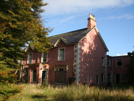
Explorer Tom Rosebank has two gabled roof projections that look like a very confused, double-hatted giant. I picture them tilting…

manse379 yd

Explorer Tom Manse in Glencrow was built around 1910. Its porch floor was recorded with coloured tiles in a geometric pattern. The…

Moville Presbyterian ChurchChurch/chapel · 414 yd

Explorer Tom Moville Presbyterian Church refuses to fall down because it has too much pride and a very stubborn slate roof that…

Rosato’sPub · 509 yd

Explorer Tom Rosato’s is on Malin Road, which sounds like a road specifically designed for people who are completely lost. Tell them…
William NorrisHouse · 519 yd

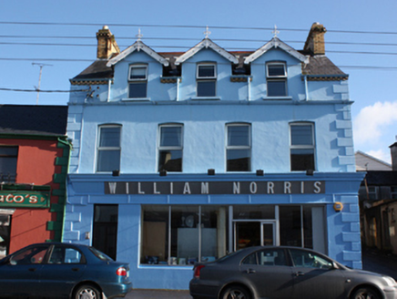
Explorer Tom William Norris house in Ballynally on Malin Street is strutting its shopfront stuff with those half-dormer openings…
DobbinsHouse · 535 yd

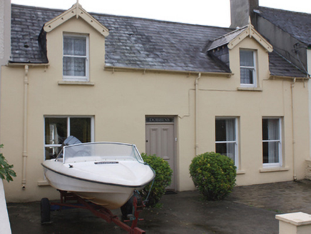
Explorer Tom Dobbins has two little dormers with pierced timber trim, each wearing its own fancy edge. The building record wonders…
BredaghHouse · 535 yd

Explorer Tom Bredagh was built around 1860 and sports one big window on the east side. I reckon someone decided a normal eye wasn't…

Maguire’sPub · 544 yd

Explorer Tom Maguire’s is basically next door to Susie’s on Main Street, creating a double-header of local gossip that never sleeps.…

Bath GreenPark · 775 yd

Explorer Tom Bath Green spreads beside Lough Foyle in Moville, with a shore walk that makes this little Donegal town feel much wider…

Carrick Field, Moville GAAGAA ground · 1632 yd

More historic places in County Donegal · All of County Donegal

Add to this placeAdd a picture Add a detailed tip Add a story

Explore the map1,095,414 places to discover

Next place · or swipebridge