What is recorded here
In pasture, on a low rise. Circular area (dims. 39m E-W; 38m N-S) defined by bank (overall Wth 4.75m; Wth at top 1.4m; int. H 0.45m; ext. H 2.05m) which is best preserved where it is incorporated into field boundary SW-NW. Remains of fosse (overall Wth 7.65m; basal Wth 3m; D 0.2m) SW-ESE. Bank appears pushed slightly outwards at SSE, where former field boundary (long axis ENE-WSW) was located. Entrance gap (basal Wth 3.5m; overall Wth 7m) at NNW and breach in bank at SSW, closed by gate. Interior is slightly higher in centre. Farm trackway (long axis ENE-WSW) to immediate S.
Compiled by: Jean Farrelly
Date of upload: 26 August 2011
A fairy fort or earthen ringfort in Meldrum, likely dating to the early medieval period, is a circular earthwork with a well-preserved bank incorporated into a field boundary. Local tradition associates such sites with fairy folklore, reflecting their perceived otherworldly or sacred significance in Scottish rural belief.
The monument record does not grant public access. Check the route and ask the landowner before entering private land.
- What survives
- Recorded monument
Places near here
 Enclosure in MeldrumEnclosure · 360 yd
 Meldrum Castle (ruins)Castle · 612 yd
 IndicatedEnclosure · 812 yd
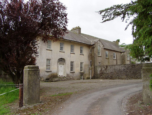 Meldrum Housecountry house · 994 yd
 Brickendown Church (in ruins)Church · 1118 yd
 The GarrisonCastle, tower house · 1.1 mi
 Ballyknock HillMountain / peak · 2.2 mi
 Cashel Folk MusuemMuseum · 3.0 mi
 Black mulberryBlack mulberry · 3.0 mi
 The Rock Of CashelVisitor information · 3.0 mi
 Cormac's ChapelHeritage attraction · 3.0 mi
 Enclosure in Rathclogh SouthEnclosure · 1160 yd