What is recorded here
Death and distance have not diminished the fort. It remains a visible marker of human presence, carrying the identity and experiences of the people who first shaped it.
On a very slight N-facing slope, in pasture, with good views from NW-N-E, 145m S of the Dead River which also forms a townland boundary with Carrig Beg. Depicted on the 1897 ed. OS 25-inch map as a large oval-shaped earthwork. Monument surveyed by the ASI in 1999 and described as a roughly circular-shaped area (42m N-S; 40m E-W) defined by a scarp (Wth 2.1m; H 0.65m) which has a cattle breach (Wth1.7m) at N and another breach (Wth 1.2m) at E. There is no obvious entrance. The interior is level, dry and clear of overgrowth. Monument is visible as a suboval-shaped earthwork on OSi orthophoto taken 2005-2012, on Digital Globe orthoimage taken 2011-2013 and on Google Earth orthoimage taken 18/11/2018.
See attached Google Earth orthoimage taken 18/11/2018
Compiled by: Alison McQueen and Vera Rahilly
Date of upload: 17 October 2020
A fairy fort or earthen ringfort in Gortnakistin, likely dating to the early medieval period, is marked on the 1897 Ordnance Survey map as a large oval-shaped earthwork. Local tradition associates such sites with fairy folklore, reflecting their perceived otherworldly significance in Irish cultural memory.
The monument record does not grant public access. Check the route and ask the landowner before entering private land.
- What survives
- Recorded monument
Places near here
 Derraun Bridgebridge · 482 yd
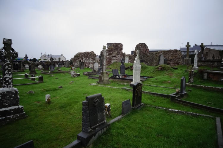 Grave YardBurial ground · 1007 yd
 BarrowBarrow, ring-barrow · 1027 yd
 Water millWater mill, unclassified · 1690 yd
 Coonagh CastleCastle · 1.0 mi
 Longford Castle (in ruins)Castle, unclassified · 1.7 mi
 ToberagaddySpring · 2.7 mi
 Oola HillMountain / peak · 2.7 mi
 KnockseefinMountain / peak · 4.1 mi
 St. Patrick's WellSpring · 6.3 mi
 Flat cemetery in Knockainy WestFlat cemetery · 10 mi
 Enclosure in Carrig BegEnclosure · 1342 yd