
What is recorded here
On a low headland on the E shore of Tyrone Bay. Aerial reconnaissance in October 1984 (ASGAP 181:74-5)
revealed a large oval enclosure (72m N-S; 55m E-W) which is defined by a low wide grassed-over stony bank. The interior is subdivided by a grassed-over stone wall running NE-SW. Some 16m from its SW end, a gap (Wth 2m) is evident. Another bank runs from the SW side of the gap, in a NW direction. The foundations of a rectangular house site (GA103-194001-) abut the W side of the dividing wall, immediately to the N of the gap. Traces of another dividing wall extend from the NW corner of the house; it runs NE towards the enclosing element.
Compiled by: Galway Archaeological Survey, UCG
Date of upload: 16 July 2019
A local fairy fort (ringfort/rath); wider significance not recorded.
The monument record does not grant public access. Check the route and ask the landowner before entering private land.
- What survives
- Recorded monument
Places near here
 MweenisharanIslet · 946 yd
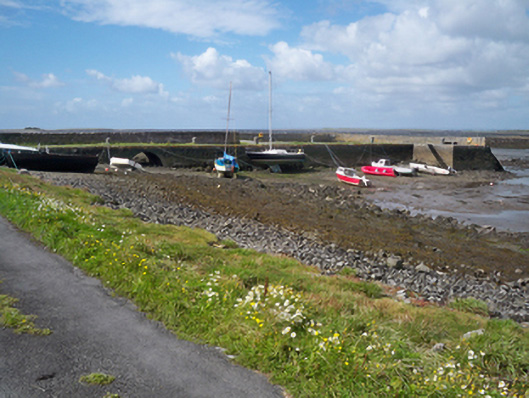 quay/wharfquay/wharf · 1171 yd
 Fulacht fia in BallynacourtyFulacht fia · 1317 yd
 Tyronehouse · 1498 yd
 Rahaneena FortFairy fort / earthen ringfort · 1.1 mi
 Drumacoo Monastic SiteHeritage attraction · 1.1 mi
 Ballynacourty Court (in ruins)Castle, hall-house · 1.2 mi
 Mweenish PointHeadland · 1.6 mi
 CastleCastle, unclassified · 1.7 mi
 Fiddaun IslandIslet · 1.7 mi
 Plumbtree FortArchaeological place · 2.5 mi
 South WoodWood · 3.4 mi
Other information
Photo: Credit not shown in the picture search · Rights wording not checked; contact us if this picture should be removed