
What is recorded here
From the National Monuments Service (Archaeological Survey of Ireland) record WA003-101
Places near here
Photo credits
- Maker not stated on source page, en.wikipedia.org
- Maker not stated on source page, ru.pinterest.com
- Golfing in Ireland; photographer not stated, Source publisher
- Maker not stated on source page, commons.wikimedia.org
- Maker not stated on source page, www.pinterest.com
- Maker not stated on source page, www.tripadvisor.com.au
- Maker not stated on source page, nycemetery.wordpress.com
- National Inventory of Architectural Heritage
- Nigel Cox, Wikimedia Commons · CC BY-SA 2.0
- Kmcnamee, Wikimedia Commons · CC BY-SA 4.0
 Ogham Stone921 yd
Explorer Tom Ogham Stone in Crehanagh South has strong opinions about the road leading to it, mostly that it's too slow. The top is…
 Crehanagh WoodsForest · 1207 yd
Explorer Tom Crehanagh Woods bragged about surviving a storm in 1998 where the wind tried to lift it up, but it held on tight out of…
 Carrick-on-Suir Golf ClubGolf course · 1340 yd
 Standing stone in Ballyquin (upperthird By.)Standing stone · 1581 yd
Explorer Tom Standing stone in Ballyquin has an overhang on the south side that looks like a tiny roof for a very small hermit.…
Standing stone in CarrickbegStanding stone · 1696 ydExplorer Tom Standing stone in Carrickbeg is a shapeless lump of conglomerate that the map makers missed because they were too busy…
 Ogham stone in CurraghnagarrahaOgham stone · 1744 yd
Explorer Tom Ogham stone in Curraghnagarraha is basically a ghost with commitment issues. It vanished so fast it didn't even leave a…
 Stone circle in Ballyquin (upperthird By.)Stone circle · 1.1 mi
Explorer Tom Stone circle in Ballyquin was called Móin a' bhrannra, meaning the cattle pen, which ruins the mystical vibe…
 St. Mary's CemeteryCemetery · 1.2 mi
Explorer Tom St. Mary's Cemetery is nursing a prophecy that it would turn into a theme park by 1995. It never happened, mostly…
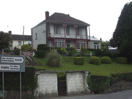 Riverview HouseHouse · 1.4 mi
Explorer Tom Riverview House has a curse that only affects people who don’t wave at it from the verandah. It’s colonial style in…
 Dillon BridgeBridge · 1.4 mi
Explorer Tom Dillon Bridge in Carrickbeg claims to hold a fake world record for being blown up and rebuilt faster than anyone can…
 CastleCastle, unclassified · 1.5 mi
Explorer Tom Castle in Carrickbeg is where the local sheep hold council meetings to decide which tourists are too loud for their…
 St. Mollerans GAA pitchGAA ground · 1.8 mi
More archaeology and monuments in County Waterford · All of County Waterford

What do you know about this place?Tap to add a comment or ask a question