
What is recorded here
From the National Monuments Service (Archaeological Survey of Ireland) record LH017-099
Places near here
Photo credits
- Maker not stated on source page, en.wikipedia.org
- Maker not stated on source page, www.flickr.com
- National Inventory of Architectural Heritage
- Kieran Campbell, Geograph · Creative Commons Attribution-ShareAlike 2.0
- Maker not stated on source page, hsreplay.net
- Mike Searle, Geograph · CC BY-SA 2.0
- Maker not stated on source page, www.irelandbeforeyoudie.com
- Vadim Manuylov, Wikimedia Commons · CC BY-SA 3.0
- Maker not stated on source page, tr.pinterest.com
- Maker not stated on source page, id.pinterest.com
 Ogham stone in BarnaveddogeOgham stone · 420 yd
Explorer Tom Ogham stone in Barnaveddoge says Vikings got lost looking for it because they couldn’t read the tiny scratches. It’s…
 Standing stone in BarnaveddogeStanding stone · 654 yd
Explorer Tom Barnaveddoge’s stone is having a massive drama with the nearest tree over who looks taller. It’s made of fine-grained…
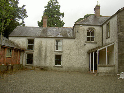 Toberdoney HouseHouse · 1339 yd
Explorer Tom Toberdoney House in Toberdoney, County Louth has started a secret fan club that meets at midnight to sing praises of…
 Trinity WellHoly well · 1355 yd
Explorer Tom Trinity Well in Paughanstown started because two lads made a bet in the pub. It's got a modern roof on iron bed…
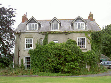 Harristown HouseCountry house · 1634 yd
Explorer Tom Harristown House brags about surviving a storm in 1794 that flattened everything else in County Louth. Its canted bays…
 Cross-inscribed stone in HoathstownCross-inscribed stone · 1656 yd
Explorer Tom This Cross-inscribed stone in Hoathstown would win the county fair by doing absolutely nothing. It’s got two crosses…
 Earthwork in RathcooleEarthwork · 1716 yd
Explorer Tom The Earthwork in Rathcoole has an opinion of the road that leads to it: it’s too flashy and gets all the attention…
 Richardstown CastleCastle, tower house · 1.2 mi
Explorer Tom Richardstown Castle has four round towers that make it look like it’s trying to hold up the sky. It’s plastered over…
 CastleCastle, unclassified · 1.2 mi
Explorer Tom Castle in Cliven witnessed a love story go wrong right next to it, involving a lot of shouting and maybe a dropped…
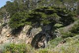 Monterey Cypress1.2 mi
Explorer Tom Monterey Cypress in County Louth does weird yoga poses when nobody's looking, twisting its branches into shapes that…
 Graveyard in Philipstown (ardee By., Mosstown Par.)Graveyard · 1.9 mi
Explorer Tom Philipstown has a low rectangular mound that looks like a giant’s bed for naps. The builder was probably thinking about…
 Kildemock GraveyardGraveyard · 1.9 mi
Explorer Tom Kildemock Graveyard in County Louth has an absolute beef with the weather because it keeps getting soggy when it tries…
More archaeology and monuments in County Louth · All of County Louth

What do you know about this place?Tap to add a comment or ask a question