
What is recorded here
From the National Monuments Service (Archaeological Survey of Ireland) record LH014-098
Places near here
Photo credits
- Maker not stated on source page, en.wikipedia.org
- Kmcnamee, Wikimedia Commons · CC BY-SA 4.0
- National Inventory of Architectural Heritage
- Kieran Campbell, Geograph · CC BY-SA 2.0
- Kieran Campbell, Geograph · Creative Commons Attribution-ShareAlike 2.0
- Dasmuy, Wikimedia Commons · CC BY-SA 4.0
- Nuala Furley, Wikimedia Commons · CC BY-SA 4.0
- Rainer Lippert, Wikimedia Commons · CC0
 Earthwork in RockEarthwork · 1076 yd
Explorer Tom Earthwork in Rock is a small circular enclosure that looks like it’s shy about being so perfectly round. If it were a…
 John Mitchels GAA pitchGAA ground · 1256 yd
 CastleCastle, unclassified · 1544 yd
Explorer Tom Castle at Harristown refuses to fall down because it’s waiting for someone to tell it it looks good, and nobody has…
 Greenvale HouseMill manager's house · 1732 yd
Explorer Tom Greenvale House in Cappocksgreen is showing off its red brick flexes like it’s on a dating profile. It thinks it’s the…
 Stickillin Church (in ruins)Church · 1.1 mi
Explorer Tom Stickillin Church makes a weird creaking sound at night that sounds exactly like someone trying to open a jar of…
 Graveyard in StickillinGraveyard · 1.1 mi
Explorer Tom Stickillin’s medieval church had stained glass found during conservation work, which is fancy for ruins. If it had to…
 The College (in Ruins)College · 1.3 mi
Explorer Tom The College in Townparks is built from limestone and greywacke, looking like it was assembled by a very confused mason.…
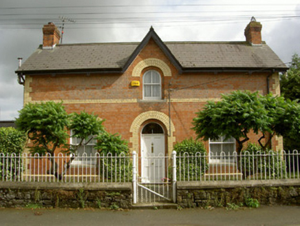 Ardee Railway StationStation master's house · 1.3 mi
Explorer Tom Ardee Railway Station in Dawsonsdemesne sings 'Choo Choo Train' because it misses the trains that used to visit. The…
 store/warehouse1.3 mi
Explorer Tom Store or warehouse in Townparks is the guy at the wedding who stands by the cake because he’s too shy to dance but…
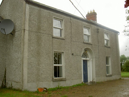 Fairview HouseHouse · 1.4 mi
Explorer Tom Fairview House is guarding its secret fanlight like a dragon hoards gold. Legend says a hero saved it from a falling…
 Ardee CastleCastle/fortified house · 1.4 mi
Explorer Tom Ardee Castle in Townparks is showing off because it's the biggest fortified house in town and knows it. It would win a…
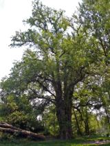 European White Elm1.7 mi
Explorer Tom European White Elm in County Louth claims a fake royal visit that nobody can disprove, complete with a lost crown…
More archaeology and monuments in County Louth · All of County Louth

What do you know about this place?Tap to add a comment or ask a question