What is recorded here
On a gentle rise in moderately drained pasture. Depicted as a circular enclosure on the Grand Jury map (1813). The monument is not visible at ground level but a curving field boundary on the 1914 edition of the OS 6-inch map may mirror the outline of its E half. O'Donovan
Date of upload: 2 February 2012
From the National Monuments Service (Archaeological Survey of Ireland) record LF023-098
The monument record does not grant public access. Check the route and ask the landowner before entering private land.
- What survives
- Recorded monument
Places near here
 Glebe HouseRectory/glebe/vicarage/curate's house · 103 yd
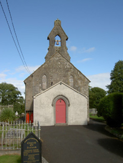 Taghshinny ChurchChurch/chapel, graveyard/cemetery · 341 ydEnclosure in Killeendowd,taghshinnyEnclosure · 794 ydIndicated FortFairy fort / earthen ringfort · 1513 ydNot locatedCastle, unclassified · 1621 ydGoldsmith Birthplace, PallasVisitor information · 1.8 mi
 Abbeyshrule AbbeyRuins · 1.8 mi
 Common Lime1.9 mi
 European Beech1.9 miNewcastle WoodsForest · 2.2 miGuest ServicesVisitor information · 2.6 mi
 Bawn in CastlereaBawn · 5.3 mi
Pictures: National Inventory of Architectural Heritage; Jamesco101, Wikimedia Commons · CC BY-SA 4.0; Alvesgaspar, Wikimedia Commons · CC BY-SA 3.0; Malene Thyssen, Wikimedia Commons · CC BY-SA 3.0; Mike Searle, Geograph · CC BY-SA 2.0
More archaeology and monuments in County Longford · All of County Longford
What do you know about this place?