What is recorded here
This record was included in the SMR (1989) as ‘enclosure -possible’, and in the RMP (1995) as ‘rectangular enclosure’ based on features visible in an aerial photograph (GSI G 18-9; Roll 156, print 22). An inspection in 1993 found no evidence of an enclosure. The features evident in the aerial photograph correspond to a natural terrace with a W-facing slope. A defunct field bank on a N-S axis traversed the E side of the terrace. The evidence is insufficient to warrant accepting this as an archaeological monument. O'Donovan
Date of upload: 19 January 2011
This record was included in the SMR (1989) as ‘enclosure -possible’, and in the RMP (1995) as ‘rectangular enclosure’ based on features visible in an aerial photograph (GSI G 18-9; Roll 156, print 22). An inspection in 1993 found no evidence of an enclosure. The features evident in the aerial photograph correspond to a natural terrace with a W-facing slope. A defunct field bank on a N-S axis traversed the E side…
From the National Monuments Service (Archaeological Survey of Ireland) record SL010-017
The monument record does not grant public access. Check the route and ask the landowner before entering private land.
- What survives
- Recorded monument
Places near here
Castle FirbisCastle, tower house · 299 ydEnclosure in QuigaboyEnclosure · 499 yd Kilglass HouseHouse · 1687 ydKilglass ChurchChurch/chapel · 1757 ydWild Atlantic Way: Inishcrone PierVisitor information · 1.9 miRathlee HeadHeadland · 2.5 miTowerSignal tower · 2.8 miEnniscrone BeachBeach / strand · 3.0 miGrave of the Black PigArchaeological place · 3.1 miMoyne AbbeyHeritage attraction · 5.1 miRoslee CastleCastle, tower house · 5.7 miWild Atlantic Way: Easky PierVisitor information · 5.7 mi
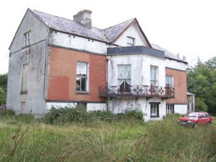 Kilglass HouseHouse · 1687 yd
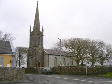 Kilglass ChurchChurch/chapel · 1757 yd
 Wild Atlantic Way: Inishcrone PierVisitor information · 1.9 miRathlee HeadHeadland · 2.5 mi
 TowerSignal tower · 2.8 mi
 Enniscrone BeachBeach / strand · 3.0 miGrave of the Black PigArchaeological place · 3.1 mi
 Moyne AbbeyHeritage attraction · 5.1 mi
 Roslee CastleCastle, tower house · 5.7 mi
 Wild Atlantic Way: Easky PierVisitor information · 5.7 mi
Pictures: National Inventory of Architectural Heritage; Florentchevallier, Wikimedia Commons · CC BY-SA 4.0; Mike Searle, Geograph · CC BY-SA 2.0; Robin Mais, Geograph · CC BY-SA 2.0; Andreas F. Borchert, Wikimedia Commons · CC BY-SA 4.0; Michael Dibb, Geograph · CC BY-SA 2.0; Mick Garratt, Geograph · CC BY-SA 2.0
More archaeology and monuments in County Sligo · All of County Sligo
What do you know about this place?