
What is recorded here
On flat pasture 75m N of the townland boundary with Meanus and 840m E of the Camoge River. Enclosure (LI031-143----) located 145m to W. Not depicted on historic OSi maps. The site is visible on the OSi orthoimages taken 2005-12 and on Digital Globe orthoimages taken 2011-2013 as the W quarter of a circular enclosure…
Read the whole record
From the National Monuments Service (Archaeological Survey of Ireland) record LI031-194
Places near here
Photo credits
- National Inventory of Architectural Heritage
- Mike Searle, Geograph · CC BY-SA 2.0
- No machine-readable author provided. Christian1965~commonswiki assumed (based on copyright claims)., Wikimedia Commons · Public domain
- Martin Richard Phelan, Wikimedia Commons · CC BY-SA 2.0
- Oliver Dixon, Wikimedia Commons · CC BY-SA 2.0
- Ballyhoura Failte, Wikimedia Commons · CC BY-SA 2.0
- Willow, Wikimedia Commons · CC BY 2.5
- Mike Searle, Wikimedia Commons · CC BY-SA 2.0
 Green LawnHouse · 585 yd
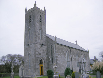 Saint Mary's Catholic ChurchChurch/chapel · 898 yd
Explorer Tom Saint Mary's Catholic Church in Meanus had a fox take charge of the parish for three days once. The stained glass is probably still confused about what actually happened during that weird week. Look up, the best bit is always at the top!
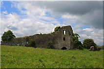 Glenogra Castle (in ruins)Castle, Anglo-Norman masonry castle · 1376 yd
 Lough GurVisitor information · 2.3 mi
 Grange Stone circleVisitor information · 2.3 mi
 Stone CirclesStone circle, embanked · 2.4 mi
Explorer Tom Stone Circles in Grange are guarded by a very serious dog that thinks he runs the place. They’re sitting on a low rise looking very smug about it. Pop by and tell it it's looking well.
 Giants GraveMegalithic tomb · 2.8 mi
Explorer Tom Giants Grave in Ballynagallagh took forty cups of tea to build, if you ask me. The stones lean so hard they're practically falling over into Lough Gur. Go with someone who loves old stuff and watch them melt completely.
Banoge's WellSpring · 3.2 miSkool HillMountain / peak · 3.2 miÁine and Gearóid Iarla: Lough GurLegend location · 3.3 miExplorer Tom Áine and Gearóid Iarla: Lough Gur has a goddess for the lake and a sleeping lord in the old stories. I thought I was coming to admire water and stones. Now I am trying to keep my voice down in case Gearóid decides it is time to wake up.
 European ash3.3 mi
Explorer Tom European ash is thinking about what the builder was really thinking when they planted it here. It stands quietly in County Limerick, waiting for someone to notice its impressive height. Ideal for a moody photo you'll pretend wasn't posed.
_-_geograph.org.uk_-_4570265.jpg/250px-Castles_of_Munster,_Ballinveala,_Limerick_(3)_-_geograph.org.uk_-_4570265.jpg "Photo: Mike Searle, Wikimedia Commons · CC BY-SA 2.0") Ballinveala Castle (in ruins)Castle, tower house · 5.2 mi
Ballinveala Castle (in ruins)Castle, tower house · 5.2 miExplorer Tom Ballinveala Castle nearly got famous when someone almost found it but looked in the wrong field. It’s four stories of brickwork pretending to be taller than it actually is. Take the long way round, it deserves the effort.
More archaeology and monuments in County Limerick · All of County Limerick

What do you know about this place?Tap to add a comment or ask a question