What is recorded here
Situated on the summit of a short N-S ridge in the Mahon river valley, overlooking the N-S stream which skirts around it c. 120-180m distant N-W-SW. This is an overgrown, subrectangular flat-topped area (dims. of top 14.2m E-W; 11.5m N-S) abutting an E-W stone field wall at S and defined at N and E by scarps (H 1.4-1.6m). A low bank (int. H 0.2m; ext. H 2.8m) is visible at the W edge with a flat-bottomed fosse (Wth of top 6.4m; Wth of base 1m; D 0.9m) and an outer bank (Wth 4.5m; ext. H 0.6m) outside it. There is no visible entrance and it does not survive S of the field wall.
Situated on the summit of a short N-S ridge in the Mahon river valley, overlooking the N-S stream which skirts around it c. 120-180m distant N-W-SW. This is an overgrown, subrectangular flat-topped area (dims. of top 14.2m E-W; 11.5m N-S) abutting an E-W stone field wall at S and defined at N and E by scarps (H 1.4-1.6m). A low bank (int. H 0.2m; ext. H 2.8m) is visible at the W edge with a flat-bottomed fosse…
From the National Monuments Service (Archaeological Survey of Ireland) record WA024-106
The monument record does not grant public access. Check the route and ask the landowner before entering private land.
- What survives
- Recorded monument
Places near here
Fulacht fia in CarrickareadyFulacht fia · 141 ydMandevilles RockCastle, unclassified · 933 yd Aughshemus BridgeBridge · 1339 ydCarrigcastle MillMill (water) · 1365 ydCopper CoastCoastal geological landscape · 1.7 miBunmahon Miners' CottagesVisitor information · 1.8 miBunmahon StrandBeach / strand · 2.0 miSt. Bernard's WellSpring · 2.4 miBallydowane CoveBeach / strand · 2.4 miBoatstrand BeachBeach / strand · 3.9 miBallinageeragh DolmenArchaeological place · 4.6 miLime KilnVisitor information · 5.1 mi
 Aughshemus BridgeBridge · 1339 yd
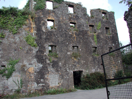 Carrigcastle MillMill (water) · 1365 yd
 Copper CoastCoastal geological landscape · 1.7 miBunmahon Miners' CottagesVisitor information · 1.8 mi
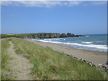 Bunmahon StrandBeach / strand · 2.0 miSt. Bernard's WellSpring · 2.4 mi
 Ballydowane CoveBeach / strand · 2.4 mi
 Boatstrand BeachBeach / strand · 3.9 mi
 Ballinageeragh DolmenArchaeological place · 4.6 mi
 Lime KilnVisitor information · 5.1 mi
Pictures: National Inventory of Architectural Heritage; Veekrokki, Wikimedia Commons · Public domain; Jonathan Thacker, Geograph · CC BY-SA 2.0; ethics girl, Geograph · CC BY-SA 2.0; Colin Park, Geograph · CC BY-SA 2.0; Alexander Redfern, Wikimedia Commons · CC BY-SA 4.0; Philip Halling, Geograph · CC BY-SA 2.0
More archaeology and monuments in County Waterford · All of County Waterford
What do you know about this place?