
What is recorded here
From the National Monuments Service (Archaeological Survey of Ireland) record WA019-005
Places near here
Photo credits
- Maker not stated on source page, www.tripadvisor.com
- National Inventory of Architectural Heritage
- Maker not stated on source page, www.gettyimages.co.uk
- Maker not stated on source page, uk.pinterest.com
- Mike Searle, Geograph · CC BY-SA 2.0
- Maker not stated on source page, www.dreamstime.com
 CastleCastle, unclassified · 1.1 mi
Explorer Tom Castle in Inchinleama hates the postman because he keeps delivering letters to a place that doesn't exist anymore. The…
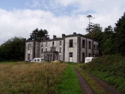 Kilmurry HouseCountry house · 1.2 mi
Explorer Tom Kilmurry House in Kilmurry South is a country house from c.1780. It has a decorative limestone portico and projecting…
 Graveyard in BallynalackenGraveyard · 1.5 mi
Explorer Tom Graveyard in Ballynalacken has been gossiping since 1779, with a hedge that probably knows everyone’s business. The…
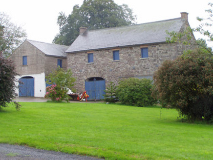 Castle CookeOutbuilding · 2.1 mi
Explorer Tom Castle Cooke outbuilding in Castlecooke is basically a car garage with a PhD in stonework, and it knows it. It would…
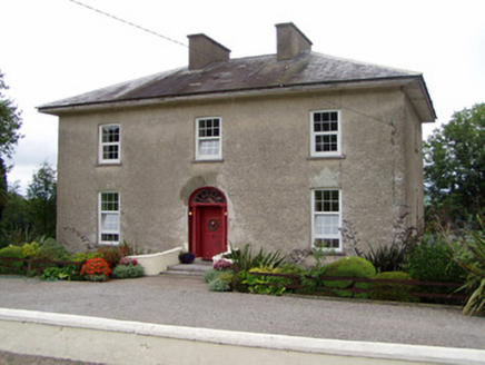 Kilbarry HouseHouse · 2.1 mi
Explorer Tom Kilbarry House has a spoked fanlight that looks like it’s stuck in a permanent expression of surprise. Built around…
 Ballyfean BridgeBridge · 3.9 mi
Explorer Tom Ballyfean Bridge claims Queen Victoria secretly crossed it in 1845 to escape her own party, and nobody can disprove it.…
 St Martins Catholic ChurchChurch · 3.9 mi
Explorer Tom St Martins Catholic Church would survive a zombie attack by locking the gallery doors and hiding behind the plaster…
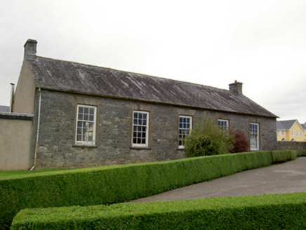 school3.9 mi
Explorer Tom School in Graigue is still doing the same old lessons from way back when. Bet two lads swore they’d build it after…
 Licklash Castle (in Ruins)Castle, hall-house · 4.3 mi
Explorer Tom Licklash Castle is perched on a cliff edge like it’s ready to jump ship at any moment. Legend says smugglers used to…
 Cist in MonadrishaneCist · 4.4 mi
Explorer Tom Cist in Monadrishane was discovered while digging a sewer in 1958, which is a grim way to find history. It was…
 Old Railway ViaductViewpoint · 4.6 mi
Explorer Tom Old Railway Viaduct has a retirement plan that involves becoming a very expensive bird feeder. It’s got iron girders…
 Fairy fort / earthen ringfort in Rath-HealyFairy fort / earthen ringfort · 4.9 mi
Explorer Tom Fairy fort / earthen ringfort in Rath-Healy was built by an Ulster chieftain's parents. No trace remains now, according…
More archaeology and monuments in County Waterford · All of County Waterford

What do you know about this place?Tap to add a comment or ask a question