What is recorded here
Situated on a NW-SE spur in a low-lying landscape between drumlins. It is depicted as a small embanked feature (ext. diam. c. 20m) only on the 1834 edition of the OS 6-inch map. No archaeological feature is visible at ground level in pasture. Revised by: Michael Moore
Date of revision: 30 January 2018
From the National Monuments Service (Archaeological Survey of Ireland) record MO027-040
The monument record does not grant public access. Check the route and ask the landowner before entering private land.
- What survives
- Recorded monument
Places near here
Fairy fort / stone ringfort in Bocks LowerFairy fort / stone ringfort · 1156 yd Laragh HouseHouse · 1219 ydThe Old Post OfficeWorker's house · 1384 ydTally WoodWood · 1.5 miFincarn HillMountain / peak · 2.9 miTobernagalliaghSpring · 3.0 miMannan Castle (in ruins)Castle, Anglo-Norman masonry castle · 4.4 miRaferaghMountain / peak · 4.6 miWedge tomb in LisnadarraghWedge tomb · 4.6 miHorse-chestnut5.0 miBush IslandIslet · 5.4 miCrane IslandIsland · 6.5 mi
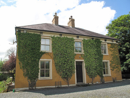 Laragh HouseHouse · 1219 yd
 The Old Post OfficeWorker's house · 1384 ydTally WoodWood · 1.5 miFincarn HillMountain / peak · 2.9 miTobernagalliaghSpring · 3.0 mi
 Mannan Castle (in ruins)Castle, Anglo-Norman masonry castle · 4.4 miRaferaghMountain / peak · 4.6 mi
 Wedge tomb in LisnadarraghWedge tomb · 4.6 mi
 Horse-chestnut5.0 mi
 Bush IslandIslet · 5.4 mi
 Crane IslandIsland · 6.5 mi
Pictures: National Inventory of Architectural Heritage; Eric Jones, Geograph · CC BY-SA 2.0; Kieran Campbell, Geograph · CC BY-SA 2.0; Wanfried-Dublin, Wikimedia Commons · CC BY-SA 4.0; Stephan van Helden, Wikimedia Commons · CC BY-SA 4.0; Oliver Dixon, Geograph · CC BY-SA 2.0
More archaeology and monuments in County Monaghan · All of County Monaghan
What do you know about this place?