
Places near here
Photo credits
- National Inventory of Architectural Heritage
- Kmcnamee, Wikimedia Commons · CC BY-SA 4.0
- Slamforeman, Wikimedia Commons · CC BY 4.0
- Colin Park, Geograph · CC BY-SA 2.0
- Oliver Dixon, Geograph · CC BY-SA 2.0
- Audrius Janecka, Wikimedia Commons · CC BY-SA 4.0
- BrendanLacey72, Wikimedia Commons · CC BY-SA 4.0
 farmyard complex325 yd
Explorer Tom Farmyard complex in Boherard had a fox take charge of the whole operation for three days straight. The Duke of…
Castle (in ruins)Castle, unclassified · 676 ydExplorer Tom Middlequarter claims to be a castle, but it's really just a rath wearing a very convincing disguise that fooled the…
TobernabraherHoly well · 1408 ydExplorer Tom Tobernabraher in Ballyharrahan witnessed a love story that went badly wrong right next to its drystone walls. It’s…
 Páirc Dungarbhain, DungarvanGAA ground · 1691 yd
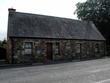 The ForgeForge/smithy · 1.4 mi
Explorer Tom The Forge in Glen Beg is having a rivalry with Blacksmiths Hall because it thinks its small-scale industrial venture…
 Waterford County MuseumMuseum · 1.6 mi
Explorer Tom Waterford County Museum in Dungarvan holds the local stories that can vanish when a grand national history marches past…
 Grattan SquareVisitor information · 1.6 mi
Explorer Tom Grattan Square would say in a job interview that its main strength is 'holding space' and its weakness is 'pigeon…
 Cunnigar PointHeadland · 1.7 mi
Explorer Tom Cunnigar Point really dislikes when tourists try to take selfies with their backs turned. It finds them incredibly…
 Dungarvan Castle (in Ruins)Castle, Anglo-Norman masonry castle · 1.7 mi
Explorer Tom Dungarvan Castle in Dungarvan is secretly proud of a potato that grew inside its wall in 1902 and was eaten by a…
 Dungarvan CastleCastle · 1.7 mi
Explorer Tom Dungarvan Castle has spent eight centuries watching the harbour as if it were expecting a very late delivery. Its odd…
Fraher Field, Waterford GAAGAA ground · 1.9 mi Master McGrathMemorial · 2.9 mi
Explorer Tom The shortcut near Master McGrath is definitely not a shortcut; it’s just a very long walk with extra steps. But the…
More archaeology and monuments in County Waterford · All of County Waterford

What do you know about this place?Tap to add a comment or ask a question