
Places near here
Photo credits
- Maker not stated on source page, commons.wikimedia.org
- National Inventory of Architectural Heritage
- Peter Taylor, Wikimedia Commons · CC BY-SA 2.0
- Kmcnamee, Wikimedia Commons · CC BY-SA 4.0
- Andreas F. Borchert, Wikimedia Commons · CC BY-SA 4.0
- Mike Searle, Wikimedia Commons · CC BY-SA 2.0
- Mike Searle, Geograph · Creative Commons Attribution-ShareAlike 2.0
 Newtown/Ballydurn GAA pitchGAA ground · 1.4 mi
 farmyard complex1.6 mi
Explorer Tom Farmyard complex in Hacketstown is where the whole parish argued about whose pig was actually the mayor. The buildings…
 Saint John's Church (Guilcagh)Church/chapel · 1.8 mi
Explorer Tom Saint John's Church in Guilcagh looks like it was designed by someone who really wanted to look medieval but ran out of…
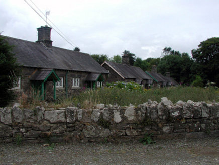 worker's house2.0 mi
Explorer Tom Worker's house in Knocknacrohy is probably judging your shoes right now. The local rabbits have formed a committee to…
 Historic buildingOfficially recorded historic building · 2.1 mi
Explorer Tom Historic building in Ballyshonock is basically a very posh postbox with a royal complex. It nearly made the national…
 Newtown FarmWater pump · 2.1 mi
Explorer Tom Newtown Farm water pump would survive a zombie attack by hiding behind its cow tail handle and pretending to be a piece…
 Croughaun HillMountain / peak · 3.2 mi
Explorer Tom Croughaun Hill has been hiding a massive scandal involving a lost hat and a very confused shepherd for centuries. The…
 John Mitchels GAA pitchGAA ground · 3.8 mi
 Abbey (in ruins)Religious house, Augustinian canons · 3.9 mi
Explorer Tom Abbey is the shortcut that isn't a shortcut because it leads to a valley and regret. St Brogan founded it, but…
 GlenshelaneUnknown · 21 mi
Explorer Tom Glenshelane is muddling through its identity crisis in Lyre East, acting like a windmill one minute and a memorial the…
 Moorstown CastleCastle · 22 mi
Explorer Tom Moorstown Castle in County Tipperary perches on a rock base that looks like it was chosen specifically to make hikers…
 Ballydoyle Castle (in Ruins)Castle · 24 mi
Explorer Tom Ballydoyle Castle is sitting next to a horse training track, which means its tombstone should read: 'Died of…
More archaeology and monuments in County Waterford · All of County Waterford

What do you know about this place?Tap to add a comment or ask a question