
Places near here
Photo credits
- National Inventory of Architectural Heritage
- D Gore, Geograph · CC BY-SA 2.0
- Eric Jones, Wikimedia Commons · CC BY-SA 2.0
- Allie_Caulfield from Germany, Wikimedia Commons · CC BY 2.0
- This file is from the Mechanical Curator collection , a set of over 1 million images scanned from out-of-copyright books and released to Flickr Commons by the British Library. View image on Flickr View all images from book View catalogue entry for book ., Wikimedia Commons · Public domain
- Kieran Campbell, Geograph · Creative Commons Attribution-ShareAlike 2.0
- Eric Jones, Geograph · Creative Commons Attribution-ShareAlike 2.0
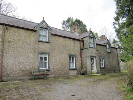 Violet ValeHouse · 1233 yd
Explorer Tom Violet Vale would be the aunt at the wedding who steals all the attention and then apologizes for it. The dormers stick out like they’re trying to peek into your business again. Go at s
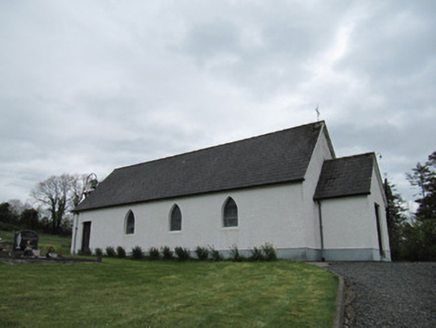 Corrinshigo Catholic ChurchChurch/chapel · 1614 yd
Explorer Tom Corrinshigo Catholic Church would win a county fair by simply standing there with its bell tower. It’s all pointed-arch windows and leaded glazing, looking more dignified than half the contestants in the ring. Bring sandwiches, the gulls are already circling and waiting for a drop.
BarraghMountain / peak · 1.1 miExplorer Tom Barragh is stuck in a property dispute with its shadow over who owns the sunset view, and neither party is willing to budge an inch. It’s got that territorial, 'this is my rock' attitude that makes it feel very exclusive indeed. Bring curiosity, leave with a better story than mine.
Bawn in DrumsheilBawn · 2.5 miExplorer Tom Bawn in Drumsheil sits on Castle Hill, which is a bit cheeky for a bawn. Piers Field nearby hints at walls that vanished into the forest fog. Have a look and decide if I was lying.
Embanked enclosureBawn · 2.5 miExplorer Tom Embanked enclosure at Pottle East is a rectangular area that the local sheep think is just another field to graze. It's been incorporated into a boundary, so it's basically part of the fence now. Sit on a wall near it and pretend you're in a painting.
Giant's GraveArchaeological place · 3.8 miExplorer Tom Giant's Grave has a family tree that is mostly made up of rocks pretending to be relatives from way back in the day. Look up, the best bit is always higher than you think, so stop staring at the ground and see the sky instead.
 Flagpole HillMountain / peak · 3.9 mi
Explorer Tom Flagpole Hill is the sort of peak that clearly had a mother-in-law design it, giving it that distinct look of permanent, passive-aggressive disappointment. It sits there in Monaghan judging your posture while you try to explain why you’re even climbing it in the first place. Stick around for the light changing, it's a show.
 Dawson MonumentMonument · 4.0 mi
Explorer Tom Dawson Monument in County Monaghan is the other one, and I’m convinced a very serious dog is actually in charge of the whole operation. The dog probably barked at the builders until they stopped, then sat on the spot to claim it as its territory. It’s got that 'I own this patch of grass' energy, even if it’s just stone. Visit, then text me what you think. I'll pretend to read it.
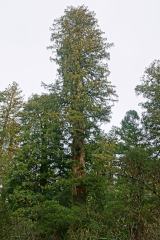 Coast Redwood4.1 mi
Explorer Tom Coast Redwood in County Monaghan is having a massive row with the village over who stole its shadow. It’s pretending to be ancient, but it’s just showing off. Bring your own legend, I’ve run out.
 Dartrey ForestForest · 4.4 mi
Explorer Tom Dartrey Forest used to have a great house at its centre, and the trees have done a fine job of carrying on without it. The Dawson family's Dartrey House was demolished in 1946. Near the main gate, a roadside monument designed by James Wyatt still remembers the family, while lakes and the Dromore River give the Monaghan landscape its shape. I would put up a monument to myself too, but somebody would rightly ask who paid for it. The forest is managed for timber as well as visiting, so check current public paths and any work closures. Keep to permitted routes and leave the old wall and monuments alone. Look across the linked water from a safe trail. The missing house is one story; the living woods have plenty of their own.
 Grave YardGraveyard · 4.9 mi
Explorer Tom Killeevan Glebe graveyard is D-shaped because the map makers were drunk one Tuesday afternoon and couldn’t decide on a square. It sits on a ridge, looking slightly confused about its own geometry. Snap one photo, then put the phone away and actually look.
 Graveyard in Drumgoon (clankee By.)Graveyard · 6.4 mi
Explorer Tom Graveyard in Drumgoon has made a New Year's resolution to stop leaning so far over the fence, but gravity is winning that battle every single time. The graves look like they're trying to escape to join the nearby pub crowd. Bring a jacket, it's never as warm as I promise.
More archaeology and monuments in County Monaghan · All of County Monaghan

What do you know about this place?Tap to add a comment or ask a question