
What is recorded here
From the National Monuments Service (Archaeological Survey of Ireland) record WA023-016
Places near here
Photo credits
- National Inventory of Architectural Heritage
- Maker not stated on source page, tr.pinterest.com
- Maker not stated on source page, www.flickr.com
- Maker not stated on source page, ru.pinterest.com
- Maker not stated on source page, au.pinterest.com
- Maker not stated on source page, en.wikipedia.org
- Maker not stated on source page, ph.pinterest.com
- Maker not stated on source page, www.pinterest.com
- Maker not stated on source page, scotlands-stories.com
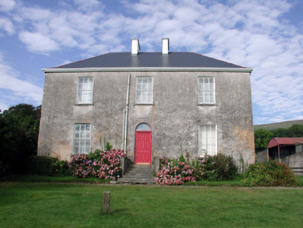 Mount KennedyHouse · 1278 yd
Explorer Tom Mount Kennedy is sick of people asking if there’s actually a Kennedy living inside or if it’s just a very confused…
 farm house1377 yd
Explorer Tom Farm house in Barnankile nearly got famous when a celebrity spotted it on a nature documentary, but they mistook it for…
 Standing stone in CarrigmoornaStanding stone · 1421 yd
Explorer Tom Standing stone in Carrigmoorna is shaped like a diamond, which makes it look like it’s trying to sell itself as jewelry…
 Castle (in ruins)House, 17th century · 1.1 mi
Explorer Tom Castle in Barnankile was designed by a mother-in-law who thought a ditch between the house and the road was good…
 Bullaun stone in Shanbally (decies Without Drum By.)Bullaun stone · 1.1 mi
Explorer Tom Bullaun stone in Shanbally looks like a giant’s coffee cup that got left out in the rain. A fox used to nap here and…
 CastleCastle, unclassified · 1.2 mi
Explorer Tom Castle in Gortavicary would put 'emotionally unavailable and structurally unsound' on its dating profile right now. It…
 Church in Curraheen (decies Without Drum By., Kilrossanty Par.)Church · 1.2 mi
Explorer Tom Church in Curraheen has been feuding with the rain for centuries and is losing badly. It’s known as Cill Loinín, which…
 Church in BallynevogaChurch · 1.3 mi
Explorer Tom Church in Ballynevoga hates visitors who talk too loudly about its non-existence, which is ironic since there’s nothing…
 Ogham stone in BallynevogaOgham stone · 1.3 mi
Explorer Tom Ogham stone in Ballynevoga has vanished so completely that even the fox who used to nap there is confused. It’s like…
Church in KnockyelanChurch · 1.5 miExplorer Tom Church in Knockyelan was once ruled by a goat that decided the fields were its kingdom. It’s unlocated, which is just…
 Standing stone in GlendalliganStanding stone · 1.6 mi
Explorer Tom Standing stone in Glendalligan is perched on a slope where the weather holds a long-standing grudge against its…
 Graveyard in Ballykeroge Big,ballykeroge LittleGraveyard · 2.3 mi
Explorer Tom Ballykeroge Big has a graveyard called 'Commins’ Little Graveyard' that remains completely unlocated, which is a…
More archaeology and monuments in County Waterford · All of County Waterford

What do you know about this place?Tap to add a comment or ask a question