Places near here
Photo credits
- National Inventory of Architectural Heritage
- Tallow GAA Club official photo album; individual photographer not named, photos.app.goo.gl
- Mike Searle, Geograph · CC BY-SA 2.0
- N Chadwick, Geograph · Creative Commons Attribution-ShareAlike 2.0
- Sitomon, Wikimedia Commons · CC BY-SA 2.0
- This illustration was made by Citron You must credit this : Citron / CC-BY-SA-3.0, Wikimedia Commons · CC BY-SA 3.0
- Jonathan Billinger, Geograph · CC BY-SA 2.0
- Kmcnamee, Wikimedia Commons · CC BY-SA 4.0
Explorer Tom Churchquarter’s ecclesiastical enclosure would tell its younger self to stop trying so hard and just let the road wall…
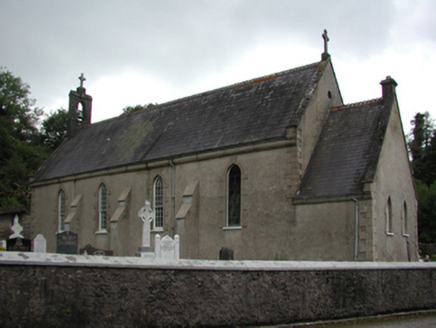 Catholic Church of the Holy CrossChurch/chapel · 1366 yd
Explorer Tom Catholic Church of the Holy Cross (Churchquarter) would post on social media: 'Just another day in the cruciform life 🙏…
 Kilmore HouseGate lodge · 1.1 mi
Explorer Tom Kilmore House gate lodge in Kilmore East is proud of its high-pitched roof, which it thinks looks very aristocratic. It…
 Páirc Eamonn De Paor, TallowGAA ground · 2.1 miTallow HillMountain / peak · 2.8 mi
Explorer Tom Tallow Hill was once offered by a cow who thought she owned the deed because she had grazed there for forty years. The…
 Lisfinny CastleCastle · 2.9 mi
Explorer Tom Lisfinny Castle makes a dreadful wheezing sound at night that locals swear is just wind, but I bet it’s actually the…
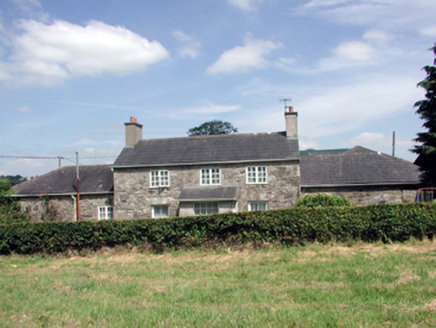 Lismore CastleFarm house · 4.8 mi
Explorer Tom Lismore Castle’s farmhouse would use its lotto win to install a very discreet dovecote that actually sings opera. It’s…
 St. Carthaghs WellHoly well · 4.8 mi
Explorer Tom St. Carthaghs Well in Lismore used to be the Forge Well until the water moved, so now everyone is confused about which…
 European Yew4.8 mi
Explorer Tom European Yew in County Waterford is where a priest lost a bet and never quite recovered his dignity afterwards. It’s…
 Delavay's magnolia4.9 mi
Explorer Tom Delavay's magnolia in County Waterford looks like it was bought at a very expensive auction by a cow with excellent…
 Sheanmore Castle (in ruins)Castle, tower house · 5.4 mi
Explorer Tom Sheanmore Castle had a poet fall into the ditch nearby who wrote a very bad poem about the mud and his dignity. The…
 Ballyduff Community Field, Ballyduff UpperGAA ground · 6.0 mi
More archaeology and monuments in County Waterford · All of County Waterford

What do you know about this place?Tap to add a comment or ask a question