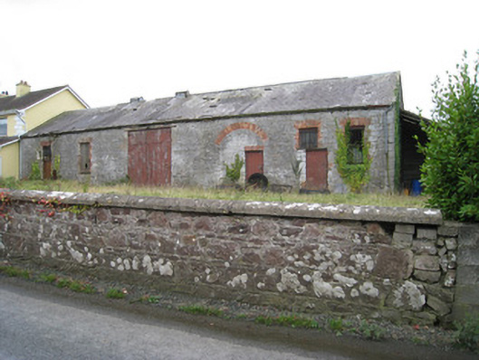
What is recorded here
Effin Creamey in Ballyshonickin was a butter factory in 1901 and disused by 1911, after the business moved to bigger premises. Even the butter got a bigger place. You’d be sick of hearing about it at Christmas.
Attached six-bay single-storey creamery, built c. 1890, with corrugated-iron addition to north-west. Pitched slate roof with metal vents and cast-iron rainwater goods. Random coursed limestone walls having dressed limestone quoins. Square-headed window openings to front (north-east) elevation having red brick block-and-start surrounds and metal sill guards. Square-headed openings with red brick voussoirs and timber battened doors. Square-headed opening having double-leaf timber battened doors. Segmental-headed carriage arch having red brick voussoirs, now partially blocked up. Random coursed sandstone boundary walls to north-east with render copings.
A creamery which once played a vital role supporting the local rural economy and which, although in poor repair, retains its original form and substantial quantities of its original fabric. The creamery was described as a "Butter Factory" operated by the Effin Creamery Company in the 1901 Census but, the operations having transferred to a larger plan (see 21905502), it was described as a "Disused Creamery" in the 1911 Census.
From the Buildings of Ireland (National Inventory of Architectural Heritage) record 21905501
This does not grant access. Most recorded buildings are privately owned; view them only from public ground unless the owner allows entry.
Places near here
ToberSpring · 945 ydLady's WellSpring · 957 yd Tobernea HousePresbytery/parochial/curate's house · 974 ydCastle (in ruins)Castle, unclassified · 1.0 miwater pump1.3 mibridge1.3 miKing John's CastleCastle · 3.4 miKings CastleCastle, tower house · 3.4 mi‘Cloigtheach (Round Tower)’Round tower · 3.5 miSeefin Mountain West TopMountain / peak · 4.8 miSeefin Mountain East TopMountain / peak · 5.2 miGrave YardGraveyard · 10 mi
 Tobernea HousePresbytery/parochial/curate's house · 974 ydCastle (in ruins)Castle, unclassified · 1.0 mi
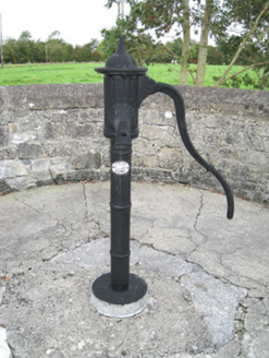 water pump1.3 mi
 bridge1.3 mi
 King John's CastleCastle · 3.4 mi
 Kings CastleCastle, tower house · 3.4 mi
 ‘Cloigtheach (Round Tower)’Round tower · 3.5 mi
 Seefin Mountain West TopMountain / peak · 4.8 mi
 Seefin Mountain East TopMountain / peak · 5.2 mi
 Grave YardGraveyard · 10 mi
Pictures: National Inventory of Architectural Heritage; The Speckled Bird, Wikimedia Commons · CC BY-SA 4.0; Andreas F. Borchert, Wikimedia Commons · CC BY-SA 4.0; Colin Park, Geograph · CC BY-SA 2.0; Hywel Williams, Geograph · Creative Commons Attribution-ShareAlike 2.0
More historic places in County Limerick · All of County Limerick
What do you know about this place?