
What is recorded here
From the National Monuments Service (Archaeological Survey of Ireland) record LH010-014
Places near here
Photo credits
- Maker not stated on source page, www.orkney.com
- National Inventory of Architectural Heritage
- Kmcnamee, Wikimedia Commons · CC BY-SA 4.0
- Maker not stated on source page, en.wikipedia.org
- Maker not stated on source page, ch.pinterest.com
- Maker not stated on source page, www.flickr.com
- Maker not stated on source page, www.pinterest.com
- Maker named on the Wikimedia Commons picture page · Public domain
- Malene Thyssen, Wikimedia Commons · CC BY-SA 3.0
- Kieran Campbell, Geograph · Creative Commons Attribution-ShareAlike 2.0
 Standing stone in Nicholastown (ardee By.)Standing stone · 1165 yd
Explorer Tom Standing stone in Nicholastown is hiding out inside a ringfort, probably because it hates crowds and bad Wi-Fi. I…
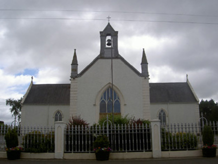 Saint Malachy's Catholic ChurchChurch/chapel · 1751 yd
Explorer Tom Saint Malachy’s Church has a strict New Year’s resolution to stop letting its stained glass get dirty. It’s all about…
 Westerns GAAGAA ground · 1754 yd
 Earthwork in Nicholastown (ardee By.)Earthwork · 1.1 mi
Explorer Tom The Earthwork in Nicholastown is a semi-circle that would order a massive portion of chips with extra mushy peas and no…
 Inscribed stone in EdmondstownInscribed stone · 1.2 mi
Explorer Tom Inscribed stone in Edmondstown would order double chips with no peas at the chipper. It’s hiding in farm buildings…
 Fairy fort / earthen ringfort in RathbodyFairy fort / earthen ringfort · 1.3 mi
Explorer Tom Rathbody’s destroyed fairy fort claims there’s a hidden treasure inside, which is definitely just an old biscuit tin.…
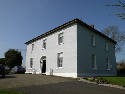 Annahean HouseHouse · 1.4 mi
Explorer Tom Annahean House shows you its side profile because it’s shy about its face, which is a bit rude really. Someone once…
 Killanny Old GraveyardGraveyard · 2.0 mi
Explorer Tom Killanny Old Graveyard in County Louth hosted a dance once that went way too far, and now the ground still feels…
 CastleCastle, unclassified · 4.7 mi
Explorer Tom Castle in Corbollis is so invisible that Saint Patrick would have walked right past it without even turning his head.…
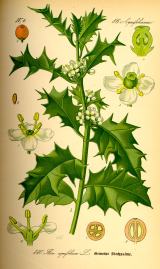 English holly5.0 mi
Explorer Tom English holly in County Louth is holding a dance that went slightly too far, spilling berries everywhere. It’s…
 European Beech5.0 mi
Explorer Tom European Beech in County Louth has a poet who fell in the ditch nearby, crying about his socks getting muddy. Have a…
 Graveyard in StickillinGraveyard · 6.7 mi
Explorer Tom Stickillin’s medieval church had stained glass found during conservation work, which is fancy for ruins. If it had to…
More archaeology and monuments in County Louth · All of County Louth

What do you know about this place?Tap to add a comment or ask a question