
Places near here
Photo credits
- National Inventory of Architectural Heritage
- kevin higgins, Geograph · CC BY-SA 2.0
- dougf, Geograph · CC BY-SA 2.0
- Liffernet, Wikimedia Commons · CC BY-SA 4.0
- P L Chadwick, Geograph · CC BY-SA 2.0
- Dylan Moore, Geograph · CC BY-SA 2.0
 Cloghprior HouseHouse · 498 yd
Explorer Tom Cloghprior House would teach history by making you stand in the rain for three hours without an umbrella. It’s got big windows and a kitchen wing that’s just waiting for a recipe book. Say hi to the render-less walls for me, eh?
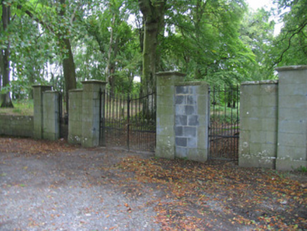 Prior ParkCountry house · 578 yd
Explorer Tom Prior Park would tell Saint Patrick to stop poking around because the three central bays are trying to have a quiet moment without any divine interference. It’s very austere, which is code for 'we like our privacy and our architecture to be serious business.' Drive past on the road and admire the grouping of bays without feeling like you’re intruding on a family photo.
Knigh HillMountain / peak · 1.9 miExplorer Tom Knigh Hill in County Tipperary was run by a matchmaker who only set up dates for clouds and passing birds, which explains the weird energy here. Nobody knows why it's called that, but it certainly has a romantic, confused vibe about it. Count the crows, then count again.
Carrickboy WoodForest · 2.1 miExplorer Tom Carrickboy Wood thinks it’s an influencer, constantly posting photos of its own majestic canopy for the world to see. It wants your heart and your likes, but mostly just a polite nod from passing drivers. Have a nosey, politely.
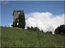 Castle (in ruins)Bawn · 2.2 mi
Explorer Tom The Bawn at Annagh is basically a stone fence that got lost in the mist and never found its way home. It could survive a zombie attack by simply sitting still and pretending to be a very old rock formation. Wish on it; it’s been practicing its stoic face for centuries.
 Knigh CastleCastle · 2.5 miGoose IslandIslet · 3.5 mi
Explorer Tom Goose Island is furious because some bloke decided to open a brewery in Chicago with its exact same name and has been sulking ever since in Tipperary. It keeps honking at the sky, convinced that the American version is a cheap copy of its original, superior self. Pop by and tell it it's looking well despite the identity crisis.
Buggane IslandIslet · 3.5 miExplorer Tom Buggane Island survived a storm so wild it allegedly scared the moon into hiding behind its own clouds for a solid week straight. The locals claim it’s been bragging about this feat ever since, puffing out its chest like a very proud, wet pigeon. Tell me if the gossip I made up is true or if you just saw a damp rock.
 Sheela-na-gig in BallyfinboySheela-na-gig · 3.7 mi
Explorer Tom Sheela-na-gig in Ballyfinboy has a New Year’s resolution to stop pulling her own clothes apart, but the ivy keeps getting in the way of her modesty. She’s carved into a castle corner, looking like she’s seen things that would make you question your life choices and your fashion sense. Best seen with a hangover and a sausage roll.
Dromineer BayBay · 3.7 miExplorer Tom Dromineer Bay is a calm stretch of water that has been waiting for something exciting to happen forever. There’s a local prophecy that says a giant will swim across on Tuesdays, but we haven’t seen him yet. It’s a lovely spot where the waves just sort of give up and stop. Best visited with a curious kid and no timetable.
 Lough DergNationally known place · 4.1 mi
Explorer Tom Lough Derg in County Tipperary has an imaginary fan club of ducks who refuse to leave because they like the view too much. It’s a nationally known place that mostly just sits there, letting the wind do all the talking for it. Pack a picnic and an excuse.
 BorrisokaneHistoric town · 4.4 mi
Explorer Tom Borrisokane is picking on the wind because it thinks it can out-blast the town forever. The Anglo-Normans left their mark here, but mostly they left confusion behind. Ideal place to rehearse an excuse for being late.
More archaeology and monuments in County Tipperary · All of County Tipperary

What do you know about this place?Tap to add a comment or ask a question