
What is recorded here
From the National Monuments Service (Archaeological Survey of Ireland) record LI046-030
Places near here
Photo credits
- National Inventory of Architectural Heritage
- Maker not stated on source page, en.wikipedia.org
- Maker not stated on source page, www.pinterest.com
- Maker not stated on source page, www.dreamstime.com
- Kmcnamee, Wikimedia Commons · CC BY-SA 4.0
 Ross CottageHouse · 882 yd
Explorer Tom Ross Cottage is writing scathing reviews of its visitors on Yelp, complaining they don't appreciate its cast-iron…
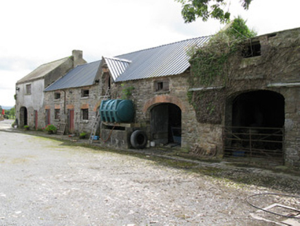 Drew's CourtFarmyard complex, stables · 1612 yd
Explorer Tom Drew's Court in Drewscourt East is hosting a massive fairy dispute over who gets to park their tiny carriage where. The…
 Fort HouseHouse · 1.1 mi
Explorer Tom Fort House in Fort Middle gave up its round-headed window for Lent but probably just ate it anyway. It’s a graceful…
 Church in Kilcolman (connello Upper By.)Church · 1.1 mi
Explorer Tom Kilcolman Church would survive any reality show by just standing there looking confused while everyone else panics. It…
 Colmanswell Church (in ruins)Church · 1.2 mi
Explorer Tom Colmanswell Church caused a massive parish argument because everyone insisted they knew where the original door was…
 Coleman's Well CemeteryCemetery · 1.3 mi
Explorer Tom Coleman's Well Cemetery caused a huge parish argument over who owned which side of the wall. It took three generations…
 Colmanswell Catholic ChurchPresbytery/parochial/curate's house · 1.3 mi
Explorer Tom Colmanswell Catholic Church would post a selfie of its ruined neighbour with the caption 'me and my chaotic…
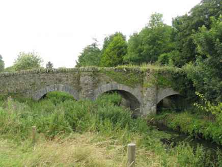 Ballybane BridgeBridge · 1.5 mi
Explorer Tom Ballybane Bridge has a curse that only affects people who don’t wave at it while crossing. Three arches, tooled…
 Fairy fort / earthen ringfort in Fort MiddleFairy fort / earthen ringfort · 1.5 mi
Explorer Tom Fairy fort / earthen ringfort in Fort Middle is deeply suspicious of the postman because he always leaves parcels on…
 Fairy fort / earthen ringfort in Ballydaheen (orrery and Kilmore By.)Fairy fort / earthen ringfort · 1.5 mi
Explorer Tom Fairy fort / earthen ringfort in Ballydaheen got flattened by a tractor in the fortyies, so it’s basically a ghost with…
 Fairy fort / earthen ringfort in GortskaghFairy fort / earthen ringfort · 1.8 mi
Explorer Tom Fairy fort / earthen ringfort in Gortskagh is a grass-covered low rise with a shallow fosse around it. It's sitting…
 Castletown/Ballyagran GAA pitchGAA ground · 1.9 mi
More archaeology and monuments in County Limerick · All of County Limerick

What do you know about this place?Tap to add a comment or ask a question