
What is recorded here
From the National Monuments Service (Archaeological Survey of Ireland) record DG093-020
Places near here
Photo credits
- Markrwillis, Wikimedia Commons · CC BY-SA 4.0
- Maker not stated on source page, genius.com
- National Inventory of Architectural Heritage
- Maker not stated on source page, au.pinterest.com
- Maker not stated on source page, commons.wikimedia.org
- Donegal GAA; photographer not stated, donegalgaa.ie
- Maker not stated on source page, readymap.irish
- Maker not stated on source page, www.pinterest.com
- N Chadwick, Geograph · CC BY-SA 2.0
 Inver Methodist ChurchChurch/chapel · 1408 yd
Explorer Tom Inver Methodist Church has a tiny bellcote above its entrance gable, pointed windows and a stone finial. Built around…
 Fairy fort / earthen ringfort in Dromore (ballintra Ed)Fairy fort / earthen ringfort · 1494 yd
Explorer Tom Fairy fort / earthen ringfort in Dromore is just an arc of bank on a drumlin, fading out at both ends into modern field…
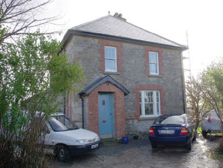 The Creamery HouseWorker's house · 1729 yd
Explorer Tom The Creamery House was built in 1916 to shelter a busy dairy boss. I bet he zipped across to the nearby creamery every…
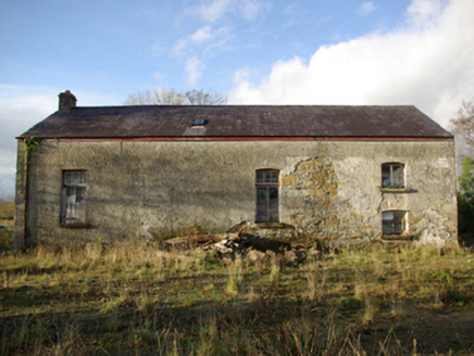 Inver CreameryCreamery · 1733 yd
Explorer Tom Inver Creamery still hides a large timber and metal churn inside! I can hear it going *chug-chug-chug* in my head…
 Munterneese Fairy FortFairy fort / earthen ringfort · 1.0 mi
Explorer Tom Munterneese Fairy Fort is a squashed oval hidden on a drumlin shoulder. The earthen bank is barely three inches high…
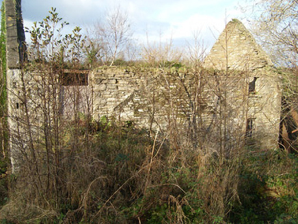 Inver Corn MilMill (water) · 1.1 mi
Explorer Tom Inver Corn Mil has a huge metal waterwheel with timber paddles that look like giant oars! I bet it used to spin so fast…
 Mapped cemeteryCemetery · 1.4 mi
Explorer Tom Mapped cemetery would bring a bag of crisps to a party because it thinks sharing is fundamental, even if most people…
 bridge1.4 mi
Explorer Tom Bridge in Cranny Lower carried the Donegal Town to Killybegs narrow gauge railway over a small road. The track was…
 Gerald Gallagher Memorial Park, St. Naul's GAA, MountcharlesGAA ground · 1.5 mi
 Kitty Joe’s CafeCafé · 1.6 mi
Explorer Tom Kitty Joe’s Cafe is open till four, so don’t stay up too late dreaming about coffee or the cat inside might be judging…
 Inver Old Church GraveyardGraveyard · 1.7 mi
Explorer Tom Inver Old Church Graveyard curves around ruins at the mouth of the Eany Water. The survey says its southwest half was…
 Salthill CabinCafé · 1.7 mi
Explorer Tom Salthill Cabin near Mountcharles is likely just a shed with a coffee machine and serious delusions of grandeur. It’s in…
More archaeology and monuments in County Donegal · All of County Donegal

What do you know about this place?Tap to add a comment or ask a question