
What is recorded here
From OpenStreetMap (© OpenStreetMap contributors) n3815428798
Places near here
Photo credits
- National Inventory of Architectural Heritage
- Maker not stated on source page, commons.wikimedia.org
- Maker not stated on source page, ru.pinterest.com
- Maker not stated on source page, www.dreamstime.com
- Thielfer, Wikimedia Commons · CC BY-SA 4.0
- Maker not stated on source page, www.pinterest.com
- Maker not stated on source page, tr.pinterest.com
- Maker not stated on source page, www.stockvault.net
 bridge685 yd
Explorer Tom The bridge in Ballymagrorty Scotch carried a road over the old Donegal Town to Ballyshannon railway. Its stone arch was…
 Giant's Grave Wedge TombWedge tomb · 798 yd
Explorer Tom Giant's Grave Wedge Tomb in Ballymagrorty is mostly a grassy bump hiding its secrets, but locals once malted barley…
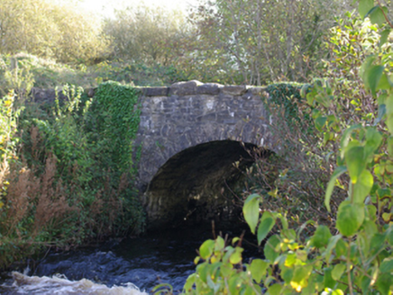 Connor's BridgeBridge · 828 yd
Explorer Tom Connor's Bridge carries a road over the Ballintra River at a junction of three roads. Built around 1820, its single…
 King of Tír Conaill's Burial MoundMound · 1058 yd
Explorer Tom King of Tír Conaill's Burial Mound is a hefty earthen bump on a hilltop. Locals say it’s where a king sleeps, which…
 Casheldoo Stone Ringfort and Penal AltarFairy fort / stone ringfort · 1091 yd
Explorer Tom Casheldoo Stone Ringfort and Penal Altar took roughly three million cups of tea to build, mostly because the workers…
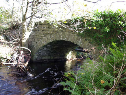 Moneymore BridgeBridge · 1349 yd
Explorer Tom Moneymore Bridge has one dressed stone arch over the Ballintra River, dating from around 1800. The old survey notes…
 Lacklom BridgeBridge · 1517 yd
Explorer Tom Lacklom Bridge would get an epitaph saying 'I held up the road so you could hold your beer,' which is pretty accurate…
 Moneymore Fairy FortFairy fort / earthen ringfort · 1543 yd
Explorer Tom Moneymore Fairy Fort sits on the crest of Horse Hill with gaps to the east and west. The earthen bank, likely scraped…
 Ballymagrorty Scotch Children's Burial GroundChildren's burial ground · 1550 yd
Explorer Tom Ballymagrorty Scotch Children's Burial Ground sits on a drumlin with a holy well at its base. It’s just a low mound…
 Drumhome ChurchRuins · 1.0 mi
Explorer Tom Drumhome Church is just a name on my map, hiding in County Donegal. I bet the drum inside its name is still waiting for…
 Drumhome GraveyardGraveyard · 1.0 mi
Explorer Tom Drumhome Graveyard holds a low grass-covered mound in its northern corner, with a dressed stone fragment at each end.…
 Mapped cemeteryCemetery · 1.0 mi
Explorer Tom Mapped cemetery would cope fine on a reality show by just standing there being quiet while the hosts try desperately to…
More mountains and hills in County Donegal · All of County Donegal

What do you know about this place?Tap to add a comment or ask a question