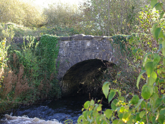
What is recorded here
Single-arch road bridge, built c. 1820, carrying road over the Ballintra River. Segmental-headed arch having roughly dressed stone voussoirs and squared rubble stone construction to the arch barrel. Roughly squared rubble stone construction to spandrels and parapets. Tarmacadam deck with vegetation to verges. Located…
Read the whole record
From the Buildings of Ireland (National Inventory of Architectural Heritage) record 40849020
Places near here
Photo credits
- National Inventory of Architectural Heritage
- Maker not stated on source page, commons.wikimedia.org
- Maker not stated on source page, www.pinterest.com
- Maker not stated on source page, tr.pinterest.com
- Maker not stated on source page, www.dreamstime.com
- Kenneth Allen, Geograph · CC BY-SA 2.0
- Kenneth Allen, Geograph · Creative Commons Attribution-ShareAlike 2.0
 bridge270 yd
Explorer Tom The bridge in Ballymagrorty Scotch carried a road over the old Donegal Town to Ballyshannon railway. Its stone arch was…
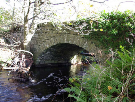 Moneymore BridgeBridge · 525 yd
Explorer Tom Moneymore Bridge has one dressed stone arch over the Ballintra River, dating from around 1800. The old survey notes…
 Giant's Grave Wedge TombWedge tomb · 602 yd
Explorer Tom Giant's Grave Wedge Tomb in Ballymagrorty is mostly a grassy bump hiding its secrets, but locals once malted barley…
 Moneymore Fairy FortFairy fort / earthen ringfort · 839 yd
Explorer Tom Moneymore Fairy Fort sits on the crest of Horse Hill with gaps to the east and west. The earthen bank, likely scraped…
 Ballymagrorty Scotch Children's Burial GroundChildren's burial ground · 957 yd
Explorer Tom Ballymagrorty Scotch Children's Burial Ground sits on a drumlin with a holy well at its base. It’s just a low mound…
 Ballintra BridgeBridge · 1059 yd
Explorer Tom Ballintra Bridge once carried the main Sligo-to-Derry mail-coach road. Its dressed stone arches and tall cutwater show…
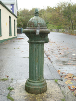 water pump1085 yd
Explorer Tom Water pump in Ballintra wears an acorn on top, yet its original lever has gone and a modern tap has taken its place.…
 Casheldoo Stone Ringfort and Penal AltarFairy fort / stone ringfort · 1256 yd
Explorer Tom Casheldoo Stone Ringfort and Penal Altar took roughly three million cups of tea to build, mostly because the workers…
 Ballymagroarty Heritage CentreHouse · 1274 yd
Explorer Tom Ballymagroarty Heritage Centre is the shortcut that isn't actually a shortcut because you have to walk around the whole…
 Ballintra Methodist ChurchChurch/chapel · 1309 yd
Explorer Tom Ballintra Methodist Church is rocking a robust rock-faced sandstone façade that looks like it’s been through a few…
 Drumhome GraveyardGraveyard · 1.1 mi
Explorer Tom Drumhome Graveyard holds a low grass-covered mound in its northern corner, with a dressed stone fragment at each end.…
 Mapped cemeteryCemetery · 1.1 mi
Explorer Tom Mapped cemetery would cope fine on a reality show by just standing there being quiet while the hosts try desperately to…
More historic places in County Donegal · All of County Donegal

What do you know about this place?Tap to add a comment or ask a question