
Places near here
Photo credits
- Mike Searle, Geograph · CC BY-SA 2.0
- National Inventory of Architectural Heritage
- Gareth James, Geograph · Creative Commons Attribution-ShareAlike 2.0
- Darrin Antrobus, Wikimedia Commons · CC BY-SA 2.0
- A.-K. D., Wikimedia Commons · CC0
- Keith Weller, Wikimedia Commons · Public domain
- A.-K. D., Wikimedia Commons · CC BY-SA 4.0
 Kilbreedy CastleCastle · 1.2 mi
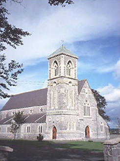 Saint Canice's Catholic ChurchChurch/chapel · 1.8 mi
Explorer Tom Saint Canice's Catholic Church has changed its name so many times it needs a legal team. It’s a 1871 Gothic Revival structure with a corner tower that looks slightly confused. Bring the dog, it'll have opinions.
 Saint Patrick's Church (Donaghmore)Church/chapel · 2.1 mi
Explorer Tom Saint Patrick's Church in Donaghmore cost 520 pounds in 1821, which probably bought you a castle and a few sheep back then. The plaque lists the wardens like they’re in a band, which is honestly quite fun to read. It’s got a feud with the next village over something daft, maybe who has the better potatoes. Stop the car, it's worth the hazard lights.
 Ballybrophy Railway StationRailway station · 2.1 mi
Explorer Tom Ballybrophy Railway Station in Kilpurcel, County Laois loves 'Yesterday' because it misses the days when trains actually stopped there. The goods shed from 1900 is just its backup plan for failure. Go before the tourists find out.
 mill (water)2.2 mi
Explorer Tom Donaghmore’s mill is derelict and probably pretending to sleep when nobody’s looking. It used to grind corn, now it just grinds your patience with broken windows. Have a sandwich here and call it a heritage lunch.
 public house2.2 mi
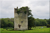 CastleCastle, tower house · 2.4 mi
Explorer Tom Castle in Grantstown is currently run by a very confident dog who barks at the wind. It was a circular tower house overlooking a lake, now just a memory. Mind the nettles, they're the real guards here.
 Aghaboe AbbeyVisitor attraction · 3.0 mi
 Font3.0 mi
Explorer Tom “Font in Aghaboe” hosted a fake royal visit that nobody can prove or deny to this day. It’s octagonal, which is fancy talk for “eight sides.” Spot the oldest stone and give it a name.
Big WoodWood · 3.4 mi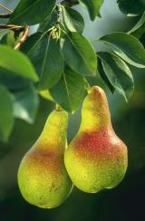 European Pear3.6 mi
Explorer Tom European Pear in County Laois is playing hard to get, much like that cow who tried to buy it with a bad note. It’s probably judging your footwear right now. Ideal stop for a big stretch and a bigger yawn.
 Grave YardGraveyard · 5.0 mi
More archaeology and monuments in County Laois · All of County Laois

What do you know about this place?Tap to add a comment or ask a question