
What is recorded here
From OpenStreetMap (© OpenStreetMap contributors) n12290667055
Places near here
Picture notes
- Computer-made picture. It does not show this monument.
- National Inventory of Architectural Heritage
- Picture: Go Visit Inishowen
- James Emmans, Geograph · CC BY-SA 2.0
- Computer-made picture. It does not show this mountain top.
- Computer-made picture. It does not show this walking route.
- Malcolm Neal, Geograph · CC BY-SA 2.0
- N Chadwick, Wikimedia Commons · CC BY-SA 2.0
 Mossyglen Children's Burial GroundChildren's burial ground · 710 ydComputer-made picture
Explorer Tom Mossyglen Children's Burial Ground sits on a slope overlooking Kinnagoe Bay, offering some genuinely fine views. It’s an oval raised mound with boulders that might be markers, and the snapped vegetation suggests someone once cleared the ground for them.
 Rose CottageHouse · 1042 yd
Explorer Tom Rose Cottage, built around 1855, is standing right where a whole little village used to be before it just vanished off the maps. I reckon the thatch roof is keeping an eye out for those missing neighbors, hoping they pop back in wearing their oldest clothes.
 Standing stone in BallymagaraghyStanding stone · 1057 ydComputer-made picture
Explorer Tom Standing stone in Ballymagaraghy stands close to the edge of cliffs that drop straight into the sea. It is a slender marker, 1.15m high, sitting on fairly level pasture land. I can’t help but imagine it leaning over the edge just to see what happens next, daring the waves to catch up.
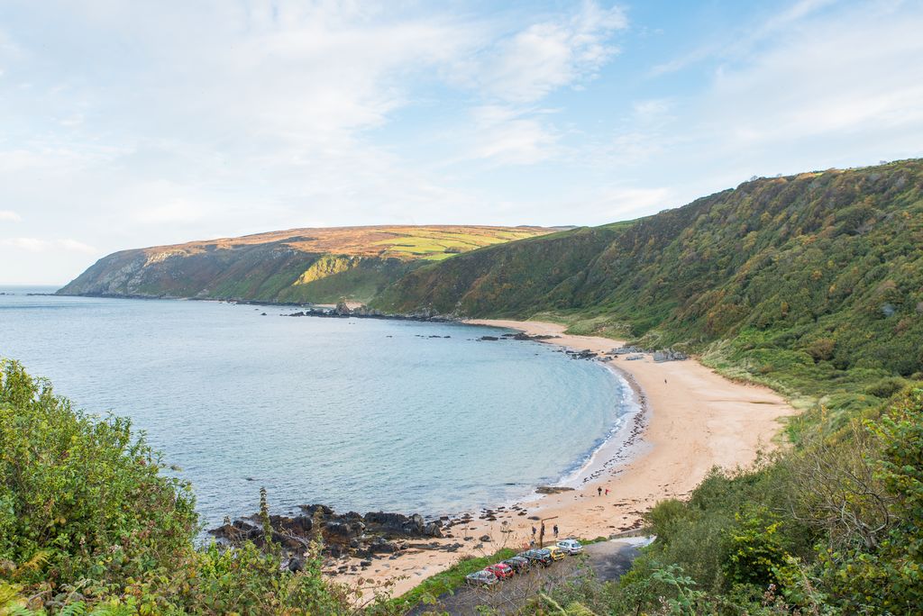 Kinnagoe BayBeach / strand · 1375 yd
Explorer Tom Kinnagoe Bay has an impressive sense of timing. La Trinidad Valencera went down here in 1588, and the wreck waited until 1971 to be found. Nearly four centuries of suspense is rude, frankly. The cove sits below steep slopes, reached by a narrow road with a hairpin bend.
 outbuilding1.2 mi
Explorer Tom Outbuilding in Ballymagaraghy has a rounded straw thatched roof built around 1780. It looks like a big, soft cushion specifically made for the Inishowen wind to punch into without getting angry. I bet it giggles every time a gust bounces off its curves.
 Tremone BayBeach / strand · 1.8 mi
Explorer Tom Tremone Bay has been keeping an icy secret in its rocks. Geological Survey Ireland records debris dropped by ancient ice in the bedrock at White Strand’s northwest end, roughly 590 to 570 million years old. I cannot blame the beach for looking smug; most places would brag about a history half that long.
 CraignamaddyMountain / peak · 2.0 miComputer-made picture
Explorer Tom Craignamaddy is vibing in its own little Donegal corner, totally unbothered by your presence. It looks like it knows a secret about the rain. A proper spot for a flask of tea and a big think, even if you're just staring at grass.
 D'Arcy Magee WalkWalking route · 2.1 miComputer-made picture
Explorer Tom D'Arcy Magee Walk is famous because a local bishop refused to visit it, claiming the wind was too rude. He’s been hiding in his tower ever since. Bring a jacket, it's never as warm as I promise.
 CrockmoreMountain / peak · 2.7 miComputer-made picture
Explorer Tom Wait, there are five Crokmores? I’m starting to doubt my own eyesight now. This one might be the real deal or just a decoy. Find the wonkiest bit and send it to your group chat for laughs.
 Michael John's PubPub · 4.1 mi
Explorer Tom Michael John's Pub has two first names, which makes it basically a committee of one. I saw a toucan on the wall, but the car park was empty and quiet. If it's closed, admire it from the road like a polite stalker.
 Cliffs, Inishowen HeadPublicly named cliff or headland · 4.3 mi
Explorer Tom Cliffs, Inishowen Head are right at the tip of the world, or so it feels. The rocks have been listening to sailors argue for centuries, and they’ve heard everything. Stand on the spot and imagine the gossip it's heard.
 Inishowen Head LoopOfficial walking route · 4.3 miComputer-made picture
Explorer Tom Inishowen Head Loop is eight point three kilometres of walking along the edge of everything. It’s moderate, but the wind makes it feel like a category five storm. Bring biscuits, every good story needs biscuits to chew on while you recover.
More mountains and hills in County Donegal · All of County Donegal

What do you know about this place?Tap to add a comment or ask a question