
What is recorded here
From the National Monuments Service (Archaeological Survey of Ireland) record CV033-020
Places near here
Photo credits
- Maker not stated on source page, commons.wikimedia.org
- Christopher Kirk, Geograph · Creative Commons Attribution-ShareAlike 2.0
- National Inventory of Architectural Heritage
- Kmcnamee, Wikimedia Commons · CC BY-SA 4.0
- Maker not stated on source page, ms.fusedlearning.com
- Kieran Campbell, Geograph · Creative Commons Attribution-ShareAlike 2.0
- Maker not stated on source page, uk.fusedlearning.com
- Kieran Campbell, Geograph · CC BY-SA 2.0
- Maker not stated on source page, en.wikipedia.org
 Fairy fort / earthen ringfort in Beagh GlebeFairy fort / earthen ringfort · 686 yd
Explorer Tom Fairy fort / earthen ringfort in Beagh Glebe is on a low rise and not visible at ground level, which is like buying a…
 Killinkere Church of Ireland ChurchChurch/chapel · 890 yd
Explorer Tom Killinkere Church started because two lads made a bet in the pub that they could build a church on a hilltop before the…
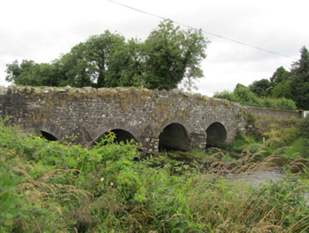 Killinkere BridgeBridge · 1125 yd
Explorer Tom Killinkere Bridge is a patchwork of rubble stone and later cut-stone arches because someone forgot to finish the job…
 Jim Smith Memorial Park, Killinkere GAAGAA ground · 1214 yd
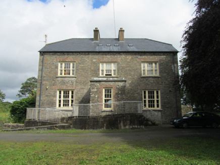 rectory/glebe/vicarage/curate's house1304 yd
Explorer Tom Rectory in Beagh Glebe is an imposing house that would definitely thrash us on a reality show because it has too much…
 Fairy fort / earthen ringfort in AnnagharnetFairy fort / earthen ringfort · 1.0 mi
Explorer Tom Fairy fort / earthen ringfort in Annagharnet has a bank that’s only identifiable from one side, which is like showing…
 Saint Ultan's Killinkere CemeteryCemetery · 1.1 mi
Explorer Tom Saint Ultan's Killinkere Cemetery in County Cavan was built on a bargain where the devil forgot to collect his fee, or…
 Stramaquerty BridgeBridge · 1.3 mi
Explorer Tom Stramaquerty Bridge is showing off its three arches like it’s a catwalk model. The cutwaters are vertical, which is a…
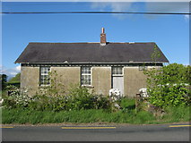 Ardlow National SchoolSchool · 1.5 mi
Explorer Tom Ardlow National School in Ardlow was built in 1897 and has that rugged rubble wall texture going on. It’s a small rural…
Fairy fort / earthen ringfort in Lisnahederna (castlerahan By.)Fairy fort / earthen ringfort · 1.5 miExplorer Tom Fairy fort / earthen ringfort in Lisnahederna: When nobody is looking, it probably reorganizes its stones to look more…
 EnaghMountain / peak · 1.7 mi
Explorer Tom Enagh in County Cavan has an imaginary twin across the sea who sends postcards every Tuesday claiming it’s taller.…
 Clanaphilip GraveyardGraveyard · 3.3 mi
Explorer Tom Clanaphilip Graveyard in County Cavan would handle a nosey neighbour by simply growing a thorn bush right over their…
More archaeology and monuments in County Cavan · All of County Cavan

What do you know about this place?Tap to add a comment or ask a question