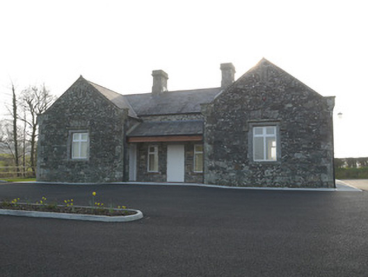
What is recorded here
Detached U-plan three-bay single-storey school, built c.1850, with lean-to canopy to middle of front facade, between advanced gabled end bays, and with recent single-storey extension to rear. Now in use as church hall by neighbouring Presbyterian church. Pitched slate roofs with kneelered gables and cut-stone copings with profiled ridge, cut-stone chimneystacks with cornices, and cast-iron rainwater goods. Render removed, exposing rubble stone walls with relieving arches over openings and quoins. Square-headed window openings throughout, those to projecting bays having chamfered ashlar stone architraves and sills and carved stone label-mouldings. Cut-stone surrounds and sills to windows to other elevations. Replacement uPVC windows throughout. Square-headed door openings to centre bay of front elevation and to inner elevations of projecting bays, with recent timber battened doors. Exposed site shared with Presbyterian church, dated 1839, to north. Site entrance to east, lined-and-ruled rendered gate piers with stepped pyramidal cappings, metal double-leaf gates. Hedges to site boundaries. Mature trees to north portion of site.
The U-plan form of this school makes it distinctive in the locality. Its kneeler gables add interest while the finely detailed ashlar sills and architraves, together with label-mouldings, add definition to the window openings. Its exposed site gives it a presence in the local landscape suited to its important educational and social role in the community. It is noted on the ordnance survey map of 1910 as 'Corvally School and Post Office'.
This does not grant access. Most recorded buildings are privately owned; view them only from public ground unless the owner allows entry.
Places near here
 Corvally Presbyterian Churchchurch/chapel · 31 yd
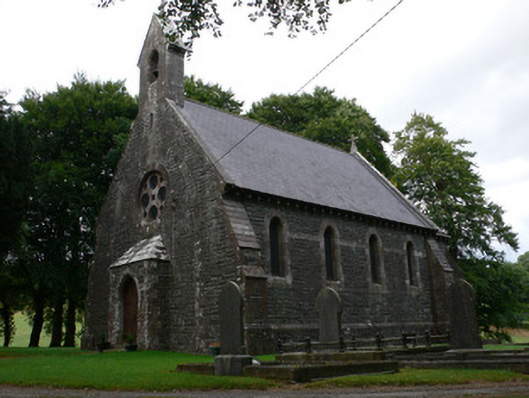 Saint Patrick's Church (Magheross)church/chapel · 301 yd
 Lisdrumturk fortFairy fort / earthen ringfort · 1495 yd
 RaferaghMountain / peak · 1753 yd
 Hut site in RaferaghHut site · 1.4 mi
 NorthlandsWood · 2.4 mi
 Bawn in LisdrumskeaBawn · 2.6 mi
 Sillan LakeshoreWood · 2.7 mi
 Bush IslandIslet · 2.9 mi
 Gull IslandIslet · 3.0 mi
 CarrickcreenyMountain / peak · 3.2 mi
 TobernagalliaghSpring · 4.8 mi
Other information
Photo: National Inventory of Architectural Heritage · Website use allowed for educational or private purposes with source credit