Places near here
Photo credits
- National Inventory of Architectural Heritage
- Hywel Williams, Geograph · Creative Commons Attribution-ShareAlike 2.0
- Brendandiamond, Wikimedia Commons · CC BY-SA 3.0
- Jonathan Thacker, Wikimedia Commons · CC BY-SA 2.0
- Richard Fensome, Wikimedia Commons · CC BY-SA 2.0
- Hywel Williams, Geograph · CC BY-SA 2.0
- David P Howard, Geograph · CC BY-SA 2.0
Explorer Tom Graveyard in Carrigane has been keeping time since 1736, right by the River Bride. It’s got a stone wall that’s probably tired of holding up all those stories about the old church. Give it a pat on the way past, it's had a long life.
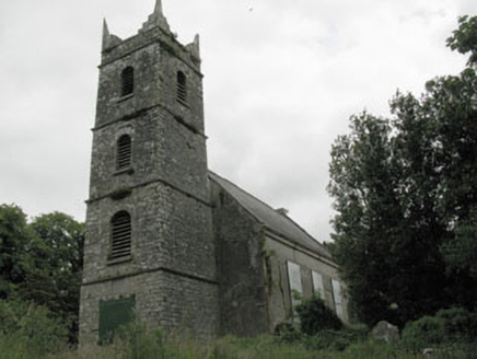 St Mary's Church of Ireland ChurchChurch/chapel · 333 yd
Explorer Tom St Mary's Church of Ireland Church is disused but still acting like the centre of the universe. It’s got a bell tower with pinnacles that look like they’re about to take off. Grand place for a nap, honestly.
Enclosure in BarnagoreEnclosure · 659 ydExplorer Tom Enclosure in Barnagore got unknowingly built upon by a factory in the 1990s, which is peak modern architecture for you. The wind keeps picking on it because it hates being under concrete. Pick a stone, any stone, and invent its biography.
 bridge1243 yd
Explorer Tom Bridge in Classes has a lightness and elegance that makes earlier bridges look like bricks. It would order a chipper and demand extra vinegar. Stand back so you don’t scare the elegance off with your breath.
Iniscarra Dam ViewViewpoint · 1.2 miExplorer Tom Iniscarra Dam View in County Cork has an imaginary twin across the sea that refuses to make eye contact unless you’re wearing a hat, which is just how things go around here. The water looks deep enough to swallow your car whole if you aren’t paying attention. Hang around long enough and you'll hear a story from a local.
 Grave YardGraveyard · 1.7 mi
Explorer Tom Graveyard in Kilnaglory has a church ruin in the middle that's seen better days. Headstones go back to 1760, so plenty of ancestors are chatting away under the dirt. Give them a wave for me!
 Ballincollig CastleCastle · 2.1 mi
Explorer Tom Ballincollig Castle in County Cork has a monogram with a 'W' and the date 1857 above the entrance. That's a specific little detail that feels like a signature from a very proud, nineteenth-century owner who liked their branding.
Ballincollig Castle (in Ruins)Bawn · 2.1 miExplorer Tom The Bawn of Ballincollig Castle has a big gap in the east wall. It runs around the edge of the rocky outcrop with rounded corners. There’s a tower inside the corner that matches the bawn wall nicely.
 Kilcrea FriaryGraveyard · 2.9 mi
Explorer Tom Kilcrea Friary in County Cork looks like it’s been losing a long argument with the local breeze for centuries. The walls are leaning over like they’re checking their phones. Best seen with a hangover and a sausage roll.
 Kilcrea CastleWood · 3.2 mi
Explorer Tom Kilcrea Castle is actually a wood pretending to be a fortress built by a very serious McCarthy. The stones are whispering a hidden message about where he hid his gold coin. Pretend you are a lost aristocrat, nobody will check your credentials.
 waterfallVisitor information · 4.3 mi
Explorer Tom Waterfall in County Cork is having a massive rivalry with the famous one over the border, claiming to be louder and more dramatic. It’s basically shouting at every tourist who walks past, just trying to prove it’s the star of the show. Bring a flask and pretend you own the place.
 Farran WoodWood · 4.5 mi
Explorer Tom Farran Wood in County Cork is where that one stubborn cow tried to buy the whole lot with a single coin and walked away looking smug. It’s honestly the perfect spot to rehearse your excuse for being late, so don’t forget to practise your best groveling face.
More caves in County Cork · All of County Cork

What do you know about this place?Tap to add a comment or ask a question