Places near here
Photo credits
- HoganStand / DG Press; individual photographer not named, hoganstand.com
- Eric Jones, Geograph · Creative Commons Attribution-ShareAlike 2.0
- National Inventory of Architectural Heritage
- Eric Jones, Geograph · CC BY-SA 2.0
- Eric Jones, Wikimedia Commons · CC BY-SA 2.0
- DarranRaff, Wikimedia Commons · CC BY-SA 4.0
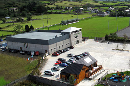 St. Patrick's GAAGAA ground · 731 yd
 Saint Mary's Catholic ChurchChurch/chapel · 734 yd
Explorer Tom Saint Mary's Catholic Church in Piedmont would survive a zombie attack by locking the doors and praying louder. It’s on…
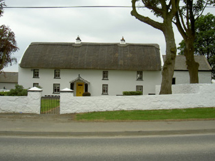 Rampark FarmhouseHouse · 840 yd
Explorer Tom Rampark Farmhouse says a poet fell into the ditch nearby and wrote a masterpiece while soaking wet. The thatched roof…
 SlievenagloghMountain / peak · 1146 yd
Explorer Tom Slievenaglogh would do brilliantly on a reality show, mostly because of the mud and the dramatic sighs. The tussocky…
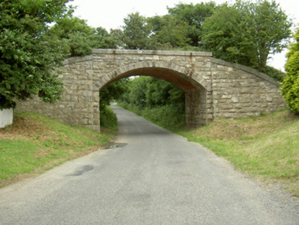 bridge1220 yd
Explorer Tom Bridge in Piedmont would survive a reality show because it has zero patience for nonsense. It used to carry trains, now…
 Piedmont House (in ruins)House, 17th century · 1227 yd
Explorer Tom Piedmont House has been around since before your great-great-great-grandparents learned to tie their shoes, yet it’s…
 Rockmarshall Court TombArchaeological place · 1.1 mi
Explorer Tom Rockmarshall Court Tomb keeps its stones low on the Cooley Peninsula, as if a prehistoric builder hid the whole thing…
 Annaloughan MountainMountain / peak · 1.3 mi
Explorer Tom Annaloughan Mountain is listening to everything you whisper through its walls and judging your life choices silently…
 Soldiers' PointHeadland · 3.7 mi
Explorer Tom Greenore Point handles its nosey neighbours by simply ignoring them and pointing at the mountains across the water…
 Giants GraveWedge tomb · 4.2 mi
Explorer Tom Giants Grave in Proleek is basically run by a dog who thinks he owns the place. The wedge tomb is gone now, but the…
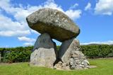 Proleek DolmenArchaeological place · 4.3 mi
Explorer Tom Proleek Dolmen balances a mighty stone in a way that makes me suspicious of my own wobbly garden wall. The portal tomb…
 Little MoatBay · 5.7 mi
Explorer Tom Little Moat is a bay that has a curse on anyone who doesn't wave properly when passing by. If your wave is too lazy…
More archaeology and monuments in County Louth · All of County Louth

What do you know about this place?Tap to add a comment or ask a question