DDiscover AloneMapAbout

Church in Singland

Church
Church in Singland
Representative picture, exact place not confirmed
Photo: Maker not stated on source page, www.tripadvisor.com.au · Report the wrong picture

The monument record does not grant public access. Check the route and ask the landowner before entering private land.

What do you know about this place?Tap to add a comment or ask a question

What you write will be public.

What is recorded here

No surface remains visible of St. Patrick's Church which was located inside St. Patrick's graveyard (LI005-029002-). The church is not visible on Google Earth orthoimage taken 28/06/2018. Described in 1827 as following; 'St. Patrick's Church stood in the S. E. Liberties at a short distance from the walls. The stones…

Read the whole record
No surface remains visible of St. Patrick's Church which was located inside St. Patrick's graveyard (LI005-029002-). The church is not visible on Google Earth orthoimage taken 28/06/2018. Described in 1827 as following; 'St. Patrick's Church stood in the S. E. Liberties at a short distance from the walls. The stones of the church and of a round tower in its vicinity are supposed to have been used by the English army for the erection of their batteries during the siege. Some remains of both were visible half a century ago. The parish contains 2,090 inhabitants, and is an entire rectory united with those of Cahiravahalla and Emly-grenan, being the corps of the Treasurership, which was valued in the King's books at £13. 6s. 8d. There is a glebe of nine acres near the site of Patrick's Church, and another of fifty acres near Emly-grenan. This parish is situated on both sides of the Shannon, and the duties are performed by the resident curates of the adjoining parishes' (Fitzgerald 1826-7, 561). Westropp gives the following details about St. Patrick's Church in the townland of Singland; 'Parish and Prebend. St. Patrick is stated to have baptised Cairthenn, son of Blatt, chief of the Dalcassians, the children of Toirdelbach, at Sengal, about 440 ("Tripartite Life," x. cent.,ed.W. Stokes, p. 207). Monkish legend derived the place-name from "Sois aingel,'" because "another angel" than " Victor" appeared to the Saint. A great victory was gained by Ceallachan, of Cashel, over the Norse at Saingeal ( Wars G. G.) in 943. Sengola, 1201, Bathgerallan, and Dromohiba pertained to it, 1224. A charter of Bishop Hubert, ante 1250, and a quit claim of John de Penrys to Sennkyll, to be held in pious memory of Bishop Bobert (died 1275), remain (B.B. L., xlviii.), Sen na ghauil, 1410; Sangole (valor), 1591 ; "St. Patrick in Singlelandprope civitatem," 1615. On July 18th, 1597, the Dean, Chapter, and Vicars Choral granted to James Cromwell, Singleland, of which the mearings were, Aghnebegh, Curraghbirrin, Frelinfourde, or Aghkillfellin, or Cloghanenemagarte; along with the "personages" and vicarages of Corkmohead, Dromcollohon, Killmyde, Cloencath, Cloneltie, and Killmollanie, with their chapels and "gleabes" to be "paid at the stone within the said cathedral" (P.R. O. I., Deeds and Wills, No. 6). Site - The graveyard alone remains. A broken round tower and ruined church are shown on the Down Survey map, 1657 (p. 13), and were levelled in 1776 (Fitzgerald, ii., p. 561); near them stood the Singland battery in the sieges of 1690-91' (Westropp 1904-5, 364). In 1906 the following details were recorded about the church and graveyard; 'Now Singland. It was here St. Patrick cured the Thomond Prince from his bodily ailment as already related. It was a very important church and had the right of sanctuary. In old maps it is represented as having a round tower beside it ; both have long since disappeared, but the site is still used as a graveyard, and popularly known as St. Patrick's' (Begley 1906, 121-2). The Down Survey map of St. Patrick's Parish depicts the ruins of a single cell rectangular church with multi-storey residential tower at W end that has been mistakenly identified as the remains of a round tower. The church and residential tower are depicted in a similar fashion of the 17th century Down Survey map of South Liberties Barony (Hib. Reg.). See attached image of church taken from Down Survey map of St. Patrick's Parish (NLI, MS 718) and image of church taken from Down Survey barony map (Hib. Reg.).

From the National Monuments Service (Archaeological Survey of Ireland) record LI005-029001

Places near here

Photo credits
  • Maker not stated on source page, www.ibelieve.com
  • Stevesphotography, Wikimedia Commons · CC BY-SA 4.0
  • Claughaun GAA club; individual photographers not named, claughaungaa.com
  • Maker not stated on source page, www.flickr.com
  • National Inventory of Architectural Heritage
  • Maker not stated on source page, www.tripadvisor.ru
  • Maker not stated on source page, za.pinterest.com
  • vincent campbell, Wikimedia Commons
  • David Hawgood, Geograph · CC BY-SA 2.0
St. Patrick's GraveyardGraveyard · 15 yd

Explorer Tom St. Patrick's Graveyard in County Limerick has a shortcut that isn't a shortcut because it leads straight back to where…

John O'Grady MonumentMonument · 473 yd

Explorer Tom John O'Grady Monument has very strong opinions on modern buildings, mostly that they’re too square and not symbolic…

Claughaun GAA pitchGAA ground · 621 ydMount Saint Lawrence CemeteryCemetery · 646 yd

Explorer Tom Mount Saint Lawrence Cemetery in County Limerick has an imaginary twin across the sea that writes it angry emails every…

Boru HouseHouse · 689 yd

Explorer Tom Boru House has a hidden message in its polychrome bricks that says 'Get a job' in Latin. It’s a horse-trading…

Saint Joseph's HospitalHospital/infirmary · 710 yd

Explorer Tom Saint Joseph's Hospital addition on Blackboy Road is being very complementary to its neighbours. Some local claims he…

Church (Site of)Church · 718 yd

Explorer Tom Church in Killalee suspects the postman is stealing all the souls he delivers. It’s gone missing so completely you’d…

Cist in KillaleeCist · 809 yd

Explorer Tom Cist in Killalee is stuck in low-lying land where the fairies argue over parking rights. A crouched skeleton was found…

Markets Field StadiumLeague of Ireland ground · 918 yd

Explorer Tom Markets Field keeps Limerick football close enough to hear the shouts from the far touchline. Treaty United call this…
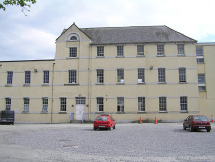
Limerick School of Art and DesignHostel (charitable) · 1049 yd

Explorer Tom Hostel in Limerick was designed by a mother-in-law who thought 'institutional economy' was a personality trait rather…

magazine1167 yd

Explorer Tom Magazine in Limerick was built by a guy who thought 'defensive' meant 'make it look like a angry fortress.' The builder…
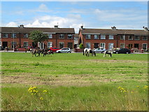
King's IslandIsland · 1.3 mi

Explorer Tom King's Island is the bit of Limerick the rivers drew for themselves. The Abbey River leaves the Shannon and joins it…

More historic places in County Limerick · All of County Limerick

Add to this placeAdd a picture Add a detailed tip Add a story

Explore the map1,095,414 places to discover

Next place · or swipeSt. Patrick's Graveyard