
What is recorded here
In pasture, 120m W of abbey (MA121-154001-). Much-ruined subrectangular church (8m N-S; 18m E-W), defined for most part by collapsed sod-covered walls (H 0.8m; Wth 0.9m). Short portion of S wall, containing window (0.66m x 0.7m), reaches a height of 3.1m. Low stone wall, N to S, divides interior in two, larger part to…
Read the whole record
From the National Monuments Service (Archaeological Survey of Ireland) record MA121-170
Places near here
Photo credits
- Maker not stated on source page, www.dreamstime.com
- Maker not stated on source page, en.wikipedia.org
- Maker not stated on source page, tr.pinterest.com
- National Inventory of Architectural Heritage
- Maker not stated on source page, storage.googleapis.com
- Kmcnamee, Wikimedia Commons · CC BY-SA 4.0
- Maker not stated on source page, www.skyscanner.ie
- Maker not stated on source page, www.hot-dinners.com
- Maker not stated on source page, www.pinterest.com
 Mapped graveyardGraveyard · 125 yd
Explorer Tom The bishop refused to visit this Mapped graveyard in Mayo because he was afraid of the crows. He said they had bad…
 Fairy fort / stone ringfort in Cahermaculick,carrowmore (kilmaine By.,moorgagagh Par.)Fairy fort / stone ringfort · 1369 yd
Explorer Tom Fairy fort / stone ringfort in Cahermaculick, Carrowmore is covered in peat because the bishop refused to visit and…
 Man-made underground passage in BullaunMan-made underground passage · 1487 yd
Explorer Tom Man-made underground passage in Bullaun is refusing to fall down like it’s got a personal grudge against gravity. It’s…
 water pump1643 yd
Explorer Tom Water pump in Cahermaculick is standing in a rural scene looking like it forgot its lines for the play. It’s a cow-tail…
 Saint Joseph's National SchoolHandball alley · 1.3 mi
Explorer Tom Saint Joseph's National School has a handball alley that’s back-to-back, which sounds like two kids fighting over the…
 Fairy fort / stone ringfort in Caherrevagh and CloonnameeltogeFairy fort / stone ringfort · 1.4 mi
Explorer Tom Fairy fort / stone ringfort in Caherrevagh And Cloonnameeltoge wants to eat less mud this year. Its New Year's…
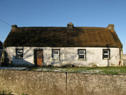 farm house1.4 mi
Explorer Tom Farm house in Brodullagh North, Mayo, is standing there with a feint battered silhouette that looks like it’s been…
 Shrule, Shrule-Glencorrib GAAGAA ground · 1.5 mi
 Mocorha Castle in ruinsCastle, tower house · 1.8 mi
Explorer Tom Mocorha Castle thinks modern buildings are for people who can’t handle the beauty of a broken vaulted ceiling. Brian…
 Ballisnahyny Castle in ruinsCastle, unclassified · 2.6 mi
Explorer Tom Ballisnahyny Castle saw a very dramatic incident where a knight dropped his sword and couldn't pick it up because he…
Glencorrib/Kilroe Community Sports Field, Shrule-Glencorrib GAAGAA ground · 3.0 mi Donaghpatrick CemeteryCemetery · 5.2 mi
Explorer Tom Donaghpatrick Cemetery in County Galway claims it was best friends with a famous rock star once. They probably just…
More historic places in County Mayo · All of County Mayo

What do you know about this place?Tap to add a comment or ask a question