
What is recorded here
Kill is likely to have originated in an early monastic foundation (KD019-008002-), and although no visible surface traces survive, the OSL (Herity 2002, 23 (65)) suggest the monastery lay on the site of, or near, the 19th century St John's Church, and Bradley et al (1986 vol. 3, 296-8) concur. In 1993, pre-development…
Read the whole record
From the National Monuments Service (Archaeological Survey of Ireland) record KD019-008006
Places near here
Photo credits
- Darrin Antrobus, Wikimedia Commons · CC BY-SA 2.0
- National Inventory of Architectural Heritage
- jwd, Geograph · CC BY-SA 2.0
- Maker not stated on source page, fity.club
- Kmcnamee, Wikimedia Commons · CC BY-SA 4.0
- Maker not stated on source page, www.interment.net
- Maker not stated on source page, www.pinterest.com
- Maker not stated on source page, www.flickr.com
- Alvesgaspar, Wikimedia Commons · CC BY-SA 3.0
- Golfing in Ireland; photographer not stated, Source publisher
- Sitomon, Wikimedia Commons · CC BY-SA 2.0
- Maker not stated on source page, en.wikipedia.org
 Saint John's Church (Kill)Church/chapel · 4 yd
Explorer Tom Saint John’s Church in Kill West claims it survived a storm that broke the neighbours’ umbrellas. The lancet windows…
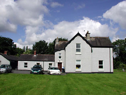 Marsville HouseHouse · 126 yd
Explorer Tom Marsville House in Kill West is showing off its weird roofline like it invented asymmetry. It’s got more gables than a…
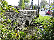 bridge130 yd
Explorer Tom Bridge in Kill East spans the stream with such confidence it probably thinks it’s a toll booth. If zombies attack, it…
 CastleCastle, tower house · 434 yd
Explorer Tom Castle in Kill East swore it would finally show its face for the New Year, but it just hid behind the farm buildings…
 Kill GAA pitchGAA ground · 679 yd
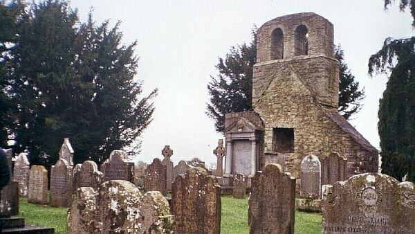 Flat cemetery in Kill East (kill Ed)Flat cemetery · 959 yd
Explorer Tom Flat cemetery in Kill East is an amorphous pit that makes a weird humming sound at night, probably because it’s…
 Bullaun stone in Hartwell LowerBullaun stone · 1403 yd
Explorer Tom Bullaun stone in Hartwell Lower was built on a bargain nobody remembers anymore. It’s just lying there near a burial…
 St. Bridgets WellHoly well · 1596 yd
Explorer Tom St. Bridgets Well in Hartwell Lower was the work of a matchmaker who knew exactly how to get couples together by curing…
 Common Lime1.3 mi
Explorer Tom This Common Lime is probably hearing every gossip session from the next door house through its bark. It doesn’t judge…
 Killeen Golf ClubGolf course · 1.6 mi
 European Yew1.7 mi
Explorer Tom Another European Yew here, probably handling a nosey neighbour by slowly poisoning their tomatoes with its roots. It…
 Castle (in Ruins)Bawn · 2.0 mi
Explorer Tom Castle in Haynestown, County Kildare hosted a dance where the floor gave out mid-waltz. The gateway is still standing…
More historic places in County Kildare · All of County Kildare

What do you know about this place?Tap to add a comment or ask a question