What is recorded here
Local tradition records this as the site of a holy well (DG045-006002-), graveyard (DG045-006003-) and a church (DG045-006001-) known as Cill an Leabhair (Church of the Book). The farm is known as Church Farm but no features survive. Bones have been found during ploughing. The site is located in a rocky wooded area…
Read the whole record
From the National Monuments Service (Archaeological Survey of Ireland) record DG045-006001
Places near here
Photo credits
- Maker not stated on source page, tr.pinterest.com
- Maker not stated on source page, www.dreamstime.com
- Maker not stated on source page, en.wikipedia.org
- National Inventory of Architectural Heritage
- Picture: Donegal Day Out
- P L Chadwick, Geograph · CC BY-SA 2.0
- Malene Thyssen, Wikimedia Commons · CC BY-SA 3.0
 Cill an Leabhair GraveyardGraveyard · 1 yd
Explorer Tom Cill an Leabhair Graveyard sits on a rocky wooded slope where the only thing left to read is the soil. It’s called…
 Holy well in Glen LowerHoly well · 1 yd
Explorer Tom The Holy well in Glen Lower is part of a vanished complex called Cill an Leabhair, or Church of the Book. No stones…
 Standing stone in Glen LowerStanding stone · 96 yd
Explorer Tom Standing stone in Glen Lower is looking south at lower ground, which feels like it’s judging everything that walks…
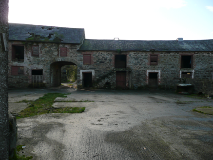 farmyard complex948 yd
Explorer Tom Farmyard complex in Carnisk is proudly displaying its unofficial world record for the most attractive rubble stone…
 Drummonaghan WoodForest recreation place · 1060 yd
Explorer Tom Drummonaghan Wood is only about a kilometre from Ramelton, yet its trees make the busy old town feel a thoughtful…
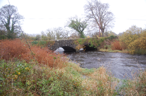 Tully BridgeBridge · 1190 yd
Explorer Tom Tully Bridge is currently being courted by a very persistent cow who keeps trying to buy it with shiny buttons and a…
 weir1198 yd
Explorer Tom Weir in Bayhill is a curvy stone wall from 1812 that looks like it’s holding back the river with its arms crossed! I…
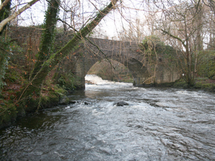 Drummonaghan BridgeBridge · 1216 yd
Explorer Tom Drummonaghan Bridge has a road that actually twists as it crosses! Built c. 1800, I wonder if the masons just got bored…
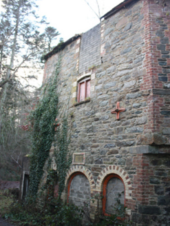 Kelly's MillKiln · 1304 yd
Explorer Tom Kelly's Mill has a plaque boasting about Charles Kellys Regd Kilns from 1873, which is a very formal way to say 'we…
 Ballyarr HouseMill (water) · 1386 yd
Explorer Tom Ballyarr House is actually a c.1800-50 corn mill that looks like it swallowed Ballyarr House whole. I bet the cast-iron…
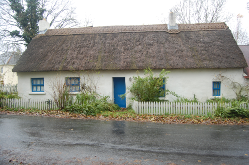 Milestone CottageHouse · 1392 yd
Explorer Tom Milestone Cottage in Ballyarr Glebe wears a wavy, scalloped thatch on its head from around 2005. It looks like the…
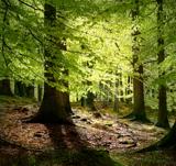 European Beech1638 yd
Explorer Tom European Beech in County Donegal would complain to the council about the lack of shade during peak afternoon hours and…
More historic places in County Donegal · All of County Donegal

What do you know about this place?Tap to add a comment or ask a question