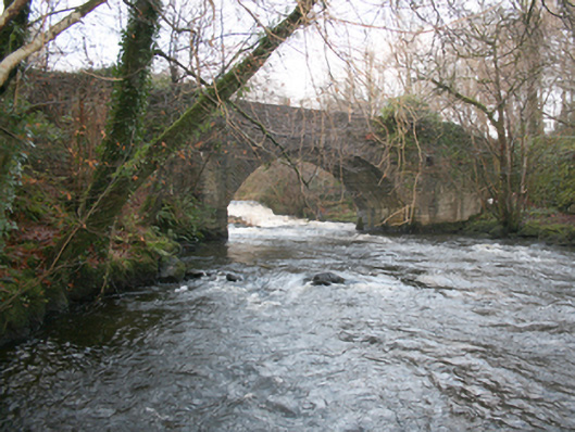
What is recorded here
Single-arched bridge carrying road over River Leanne, built c. 1800, having small single-arched bridge over former millrace associated with corn mill (see 40800301 and 40800302) adjacent to the north-east. Segmental-headed arch with roughly dressed stone voussoirs; squared rubble stone construction to arch barrel.…
Read the whole record
From the Buildings of Ireland (National Inventory of Architectural Heritage) record 40800210
Places near here
Picture notes
- P L Chadwick, Geograph · CC BY-SA 2.0
- National Inventory of Architectural Heritage
- Malene Thyssen, Wikimedia Commons · CC BY-SA 3.0
- Computer-made picture. It does not show this monument.
- Computer-made picture. It does not show this playground.
- Kenneth Allen, Wikimedia Commons · CC BY-SA 2.0
- Kenneth Allen, Geograph · CC BY-SA 2.0
- Heikki.vesanto, Wikimedia Commons · CC BY-SA 4.0
- Richard Webb, Geograph · CC BY-SA 2.0
- Computer-made picture. It does not show this mountain top.
 weir19 yd
Explorer Tom Weir in Bayhill is a curvy stone wall from 1812 that looks like it’s holding back the river with its arms crossed! I wonder if the water ever tried to sneak around the side and make a mess? It feels like a very stubborn old gatekeeper who never took a break.
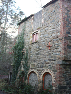 Kelly's MillKiln · 88 yd
Explorer Tom Kelly's Mill has a plaque boasting about Charles Kellys Regd Kilns from 1873, which is a very formal way to say 'we dried corn here.' I love that it might be hiding bits of an older structure from 1834 inside its sturdy stone walls. It’s the perfect spot for a yarn about how much effort we put into keeping our grain dry.
 European Beech439 yd
Explorer Tom European Beech in County Donegal is just a tree, but make it sound important or people will think you’re wasting time. It’s probably plotting something against the squirrels or the weather. Ten minutes here and you'll have a yarn for the pub, claim you spoke to its roots.
 Bullaun stone in Glen LowerBullaun stone · 993 ydComputer-made picture
Explorer Tom Bullaun stone in Glen Lower sounds like it’s got a really important name that nobody knows yet. Maybe it’s actually a giant cushion for fairy queens, or just a very confused rock pretending to be something else.
 Children's playground1008 ydComputer-made picture
Explorer Tom Children's playground in County Donegal would order triple chips, extra mayo, and a mystery meat patty if it had a chipper on site. It’s got that sort of appetite. Bring a jacket, because it’s never as warm as I promise you it will be.
 Architectural fragment in RathmeltonArchitectural fragment · 1049 ydComputer-made picture
Explorer Tom Architectural fragment in Rathmelton sports two medieval blocks where a lion bites a vine and conjoined cats guard the peace. They’re sitting right outside the Church of Ireland, looking like they’ve been waiting for centuries to show off their weird carvings.
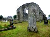 Tullyaughnish Old Church GraveyardGraveyard · 1129 yd
Explorer Tom Tullyaughnish Old Church Graveyard has been hanging around since 1622, which is basically forever in church years. Sir William Stewart built it, so the locals were definitely keeping up with the trends back then. I bet the ghosts are still complaining about the new church. Take a pic of the old stones!
 O'Shaughnessy's BarPub · 1239 yd
Explorer Tom O'Shaughnessy's Bar in Ramelton is open late, so grab a pint and keep me company while I get lost. It’s getting dark out here, and I can’t find my way back. Go with someone who loves old stuff and watch them melt.
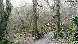 Ballyarr Nature ReserveNational nature reserve · 2.0 mi
Explorer Tom Ballyarr Nature Reserve holds a surviving sliver of Donegal’s ancient oak forest. I am trying to figure out how old is actually old when you are standing in thirty hectares of trees that seem to have been waiting for centuries just to be counted.
 Carrs Of The DiamondPub · 2.2 mi
Explorer Tom Carrs Of The Diamond sounds like a pub built on a rock that might roll away at any moment. Sit on the edge and enjoy the wobble while you watch the locals pretend they know what's happening. Toast it with a cup of tea and move on to the next.
 Mullan HillMountain / peak · 4.6 miComputer-made picture
Explorer Tom Mullan Hill in County Donegal is the perfect spot to forget your phone exists for exactly ten minutes. A good place to forget your phone for ten minutes, unless you want to die of boredom.
 Trusk BegMountain / peak · 5.1 miComputer-made picture
Explorer Tom Right, so we've got Trusk Beg in County Donegal, and I'm betting the 'Beg' bit means it's a bit of a bruiser. I imagine it's the sort of peak that looks friendly enough from below but gives you a proper once-over when you get close.
More historic places in County Donegal · All of County Donegal

What do you know about this place?Tap to add a comment or ask a question