
Places near here
Photo credits
- National Inventory of Architectural Heritage
- Kenneth Allen, Wikimedia Commons · CC BY-SA 2.0
- Richard Webb, Geograph · CC BY-SA 2.0
- Heikki.vesanto, Wikimedia Commons · CC BY-SA 4.0
- Kenneth Allen, Geograph · CC BY-SA 2.0
- Andreas F. Borchert, Wikimedia Commons · CC BY-SA 4.0
- Percita at Flickr, Wikimedia Commons · CC BY-SA 2.0
- Chris Gunns, Wikimedia Commons · CC BY-SA 2.0
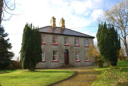 Ivy CottageHouse · 899 yd
Explorer Tom Ivy Cottage was built around 1900 with a pair of stepped yellow-brick chimneys on the roof and a tall coloured-glass window by the stairs. I thought the chimneys would steal the show, then the staircase got its own coloured light.
 Meenatole National SchoolSchool · 2.4 mi
Explorer Tom Meenatole National School dates to 1897, as its sandstone plaque says. Behind it, a wall once separated the girls’ and boys’ play areas. I expected the rules to be inside the classroom; this one was built into the yard.
 Carrs Of The DiamondPub · 2.5 mi
Explorer Tom Carrs Of The Diamond sounds like a pub built on a rock that might roll away at any moment. Sit on the edge and enjoy the wobble while you watch the locals pretend they know what's happening. Toast it with a cup of tea and move on to the next.
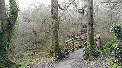 Ballyarr Nature ReserveNational nature reserve · 3.0 mi
Explorer Tom Ballyarr Nature Reserve holds a surviving sliver of Donegal’s ancient oak forest. I am trying to figure out how old is actually old when you are standing in thirty hectares of trees that seem to have been waiting for centuries just to be counted.
 The Yellow PepperRestaurant · 3.0 mi
Explorer Tom The Yellow Pepper in Letterkenny sounds spicy, but it’s just a restaurant on Lower Main Street. Grab a chilli if you’re brave; I’ll wait here shivering. Stick around for the light changing, it's a show.
 Gregory HillMountain / peak · 3.6 mi
Explorer Tom Gregory Hill stands in County Donegal, keeping its access details firmly unknown. The name sounds like a word you’d mumble into your breakfast cereal, yet it sits there as a solid geological fact without offering a single helpful footpath.
 Conwal Wheeled Cross SlabCross-slab · 3.7 mi
Explorer Tom Conwal Wheeled Cross Slab is a tiny, battered fragment that survived the mess of a 1968 tidy-up. It’s just the top half of a wheeled cross, weathered smooth on the cairn. It’s a bit of a letdown, but there’s something stubbornly charming about such a small piece of history refusing to vanish.
 Godfrey O'Donnell GraveslabGraveslab · 3.7 mi
Explorer Tom Godfrey O'Donnell Graveslab claims to be the final resting spot of a guy who died in 1258. It’s got a wheeled-cross with some fancy interlace that looks like Celtic knotting meets a bicycle wheel. The corner is broken, but the carving is still sharp enough to make you wonder if Godfrey was actually into cycling.
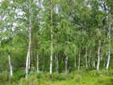 Silver Birch3.7 mi
Explorer Tom Silver Birch in County Donegal is showing off its white skin like a movie star. It's very flaky, literally, and needs permission to shed its leaves without embarrassment. Tell it to keep those peels coming for the birds.
 Battle at Doon Rock, KilmacrennanBattle · 3.8 mi
Explorer Tom Battle at Doon Rock, Kilmacrennan in County Donegal is where Sir Cahir O'Doherty finally lost his battle against a rock. Legend says a very confused goat actually ruled this patch for three minutes before getting kicked out. Bring someone who'll believe anything.
 Battlefield in Ardahee,ballyconnelly (ballymacool Ed),bomany,doon GlebeBattlefield · 4.3 mi
Explorer Tom Battlefield in Ardahee in County Donegal is where history got messy and people stopped talking about it. It’s a field full of old arguments and new grass. Find a local and ask them the real story, then come back and tell me.
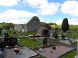 Stackarnagh Abbey GraveyardGraveyard · 4.7 mi
Explorer Tom Stackarnagh Abbey Graveyard has a gatepost detail I keep coming back to: a reused window fragment carved with a fish biting the end of a moulding, with a rough unicorn above it. The survey says the stone probably came from the church's ruined south window. I can enjoy the odd pair without inventing what the medieval carver meant.
More mountains and hills in County Donegal · All of County Donegal

What do you know about this place?Tap to add a comment or ask a question