What is recorded here
Marked on Taylor's 1783 Map of County Kildare. According to the OSL (Herity 2002, 12 (35, 36)), ' … there lies in an open field, a graveyard (KD014-016001-) without a fence and within it a portion of a wall, the only remaining part of an old church that stood there.' OMURETHI (1909-11, 206-7, 209) records, '…
Read the whole record
From the National Monuments Service (Archaeological Survey of Ireland) record KD014-016
Places near here
Photo credits
- Maker not stated on source page, readymap.irish
- Maker not stated on source page, www.flickr.com
- Discover Ireland; photographer not stated, Discover Ireland
- Maker not stated on source page, www.gettyimages.com
- Maker not stated on source page, www.pinterest.com
- Ian Paterson, Geograph · CC BY-SA 2.0
- National Inventory of Architectural Heritage
- Branaigh, Wikimedia Commons · CC BY-SA 4.0
- Sheila1988 / Wikimedia Commons, commons.wikimedia.org
- Ardclough GAA official club site; individual photographer not stated, ardcloughgaa.clubzap.com
- Maker not stated on source page, commons.wikimedia.org
 Graveyard in Castledillon UpperGraveyard · 22 yd
Explorer Tom Graveyard in Castledillon Upper, County Kildare is unfenced and open, so anyone can wander in and disturb the peace…
 TombTomb, effigial · 22 yd
Explorer Tom Tomb in Castledillon Upper has a grand retirement plan, but the stone went to town for a holiday. It's just an empty…
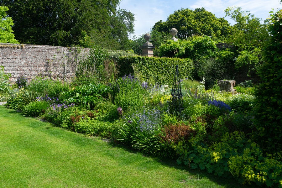 Lodge Park Walled GardenGarden · 1244 yd
Explorer Tom Lodge Park Walled Garden in Straffan hides two acres of growing ambition behind eighteenth-century walls, with roses…
 Fairy fort / ringfort in ReevesFairy fort / ringfort · 1396 yd
Explorer Tom Fairy fort / ringfort in Reeves is being picked on by the wind because it can’t be seen from the ground. It’s just a…
 CastleCastle, unclassified · 1454 yd
Explorer Tom Castle in Ardrass Upper is playing hide-and-seek with me. A tale from 1655 says a fox took charge here, but there was…
 Reeves CastleCastle · 1474 yd
Explorer Tom Reeves Castle seems to have a permanent glare at any tourist who thinks they’re too cool for the countryside. It’s…
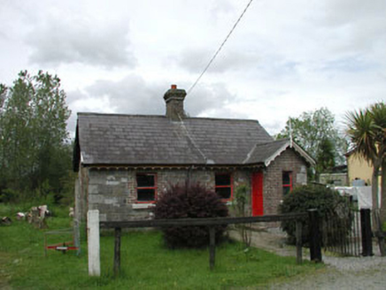 Straffan Railway StationStation master's house · 1501 yd
Explorer Tom Straffan’s station master’s house is dressed in more colors than a disco ball at a funeral. It would complain to the…
 Battle of GlenmamaMajor battlefield · 1687 yd
Explorer Tom Battle of Glenmama in County Kildare has an imaginary fan club that meets only when the fog rolls in thick. They argue…
 Straffan GAA pitchGAA ground · 1700 yd
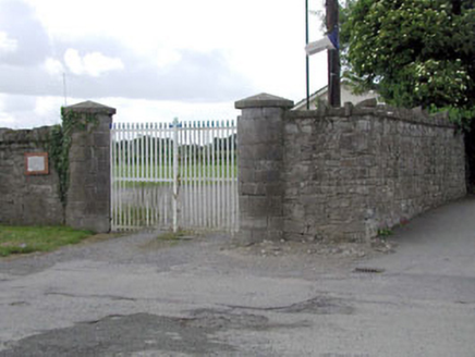 demesne walls/gates/railings1.0 mi
Explorer Tom Lodgepark’s demesne walls are holding up like a stubborn old aunt who refuses to go to bed, even though the stones are…
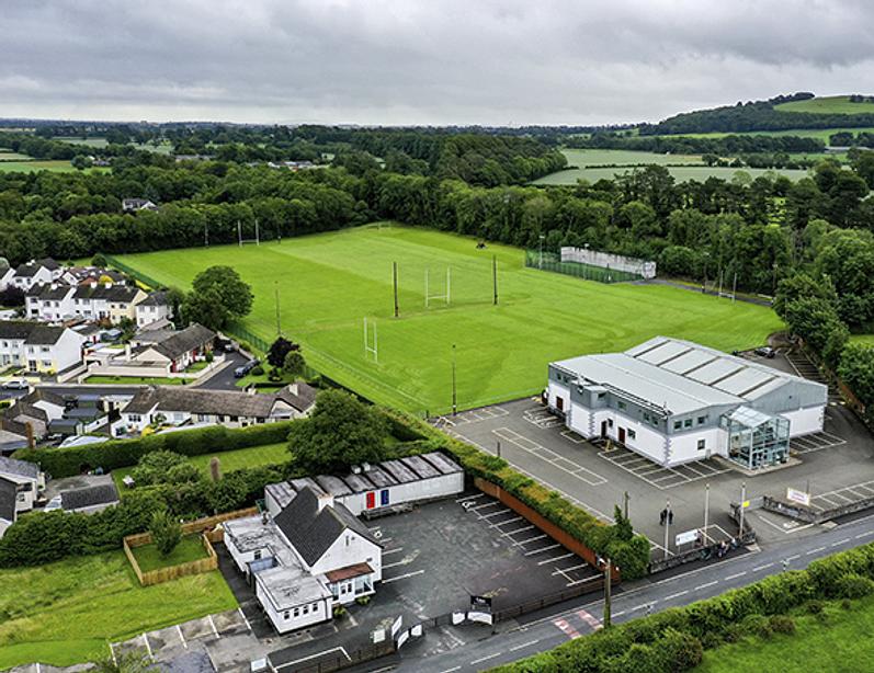 Ardclough GAA pitchGAA ground · 1.1 mi
 Graveyard in Ardrass LowerGraveyard · 1.1 mi
Explorer Tom Graveyard in Ardrass Lower, County Kildare has no visible graves or markers, which means everyone is sleeping naked…
More historic places in County Kildare · All of County Kildare

What do you know about this place?Tap to add a comment or ask a question