DDiscover AloneMapAbout

Church in Carrowhugh

Church
Church in Carrowhugh
Representative picture, exact place not confirmed
Photo: Maker not stated on source page, www.tripadvisor.com.my · Report the wrong picture

The monument record does not grant public access. Check the route and ask the landowner before entering private land.

What do you know about this place?Tap to add a comment or ask a question

What you write will be public.

What is recorded here

'Kilblaney Burial Ground' (DG022-002005-) consists of a subrectangular enclosure c. 25m E-W and c. 15m N-S defined on three sides by a wall and on the fourth by a cliff edge. Near the centre of the graveyard are three drystone walls each c. 1m wide by 0.8m high forming a rectangle, 4m N-S and. 5m E-W internally, open…

Read the whole record
'Kilblaney Burial Ground' (DG022-002005-) consists of a subrectangular enclosure c. 25m E-W and c. 15m N-S defined on three sides by a wall and on the fourth by a cliff edge. Near the centre of the graveyard are three drystone walls each c. 1m wide by 0.8m high forming a rectangle, 4m N-S and. 5m E-W internally, open to the W end. This is said to be the remains of a 'church' (DG022-002001-) but may alternatively be the remains of a small drystone enclosure. In the NE quadrant of this structure there are the remains of a low rectangular flat-topped rubble cairn known as an 'altar' which may be the remains of a leacht (DG022-002007-). On the W side of the 'altar' or leacht there is a cross- inscribed slab (DG022-002002-), .85m × 0.26m to .33m. On the W face of the slab is carved a plain Latin cross. Beside this slab and lying on top of the 'altar' there was a quern-stone that has since been moved to the nearby maritime museum in Greencastle. Just N of the entrance on the W side of the graveyard is a small, stone cross (DG022-002004-) supported by one half of a stone socket. There are many grave markers in the enclosure which is situated on a cliff edge overlooking the entrance to Lough Foyle. According to the local landowner a second slab decorated with scrollwork located to the N of the possible church was removed from the site in recent times and its current location is unknown. The arrangement of the leacht and the enclosure enclosure is similar in layout to the leacht and enclosure known as Ollamurray on the island of Inishmurray, Co. Sligo (O'Sullivan & O Carragain 2008, 298-313). No church is indicated inside this burial ground on the first edition of the Ordnance Survey 6-inch map. However in 1834 the Topographical Dictionary of Ireland recorded that 'on a detached rock, about a mile distant, are the ruins of Kilblaney church: previously to 1620 Kilblaney formed a separate parish' (Lewis 1837 vol. 2, 399). O'Sullivan, J. & O Carragain, T. 2008 Inishmurray monks and pilgrims in an Atlantic landscape. The above description was derived from the 'Archaeological Survey of County Donegal. A description of the field antiquities of the County from the Mesolithic Period to the 17th century.' Compiled by: Brian Lacey with Eamon Cody, Claire Cotter, Judy Cuppage, Noel Dunne, Vincent Hurley, Celie O'Rahilly, Paul Walsh and Seán Ó Nualláin (Lifford: Donegal County Council, 1983).

From the National Monuments Service (Archaeological Survey of Ireland) record DG022-002001

Places near here

Photo credits
  • Maker not stated on source page, en.wikipedia.org
  • National Inventory of Architectural Heritage
  • Malcolm Neal, Wikimedia Commons
  • Patrick Mackie, Geograph · CC BY-SA 2.0
  • Golfing in Ireland; photographer not stated, Source publisher
  • Malcolm Neal, Geograph · CC BY-SA 2.0
  • Corinna Schleiffer, Wikimedia Commons · CC BY-SA 2.0
  • Kenneth Allen, Wikimedia Commons · CC BY-SA 2.0
Kilblaney Old Burial GroundGraveyard · 3 yd

Explorer Tom Kilblaney Old Burial Ground sits on a cliff edge where one side is just... water. There’s a small stone cross and a…
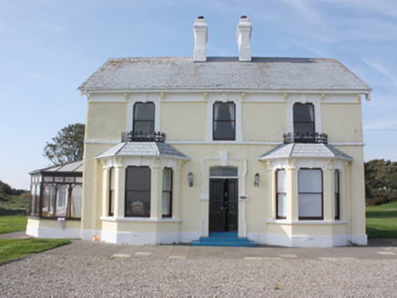
St. Michall'sHouse · 339 yd

Explorer Tom St. Michall's, built c. 1870, has wrought-iron ridge-cresting that acts as a sill-guard. I reckon those fancy iron…

Sweet Nellie'sBeach / strand · 396 yd

Explorer Tom Sweet Nellie's is a small beach near Greencastle with a name fit for a friendly aunt and a sea quite capable of…

White StrandBeach / strand · 419 yd

Explorer Tom White Strand near Greencastle is the sort of small Inishowen beach that lets you drive past without noticing, then…

Carrowtrasna Burial Ground / Mass RockBurial ground · 598 yd

Explorer Tom Carrowtrasna Burial Ground / Mass Rock uses natural rock ledges as walls, saving the builders some serious effort.…

Greencastle Golf ClubGolf course · 778 ydMichael John's PubPub · 887 yd

Explorer Tom Michael John's Pub has two first names, which makes it basically a committee of one. I saw a toucan on the wall, but…

Warren LighthouseLighthouse · 904 yd

Explorer Tom Warren Lighthouse is round, its windows are square, and the light on top has several sides. For passing gulls, the…

Inishowen LighthouseLighthouse · 1671 yd

Explorer Tom Inishowen Lighthouse began guiding ships into Lough Foyle in 1837 with twin granite towers. A local tale says a…

Stroove LighthouseLighthouse · 1674 yd

Explorer Tom Stroove Lighthouse sits near Inishowen Head with beach, Lough Foyle and open sea conspiring to make its pale tower look…
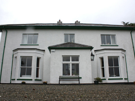
Porta VillaHouse · 1.0 mi

Explorer Tom Porta Villa in Greencastle is where a fiddler played all night until the sun came up and gave him a headache. He was so…

Dunagree PointHeadland · 1.1 mi

Explorer Tom Dunagree Point sits at the mouth of Lough Foyle with two old lighthouse towers keeping company and a view that makes…

More historic places in County Donegal · All of County Donegal

Add to this placeAdd a picture Add a detailed tip Add a story

Explore the map1,095,414 places to discover

Next place · or swipeKilblaney Old Burial Ground