What is recorded here
Situated on the crest of a ridge running E-W with gently sloping ground to the N and S. Rectangular structure (dims. 11m E-W; 7m N-S) of uncoursed mortared rubble (T 1m; H 1.2-1.5m). No indication of door or window positions. It is in the centre of a rectangular graveyard defined by stone walls. There is no trace of the church marked on the OS 6-inch maps in the separately walled graveyard to the E.
Test trenching (Excavation Licence 08E0699) carried out in 2008 to facilitate the development of the sports complex did not reveal anything of archaeological significance (Whitty 2011, 378).
From the National Monuments Service (Archaeological Survey of Ireland) record WI043-020
Places near here
Photo credits
- National Inventory of Architectural Heritage
- Sarah777 at English Wikipedia, Wikimedia Commons · Public domain
- Maker named on the Wikimedia Commons picture page · CC BY-SA 2.5
- Miguel Angel Masegosa Martínez, Wikimedia Commons · CC BY 2.0
- Jonathan Billinger, Wikimedia Commons · CC BY-SA 2.0
Enclosure in CoolafancyEnclosure · 499 ydIndicatedEnclosure · 1175 yd Cummer ValeFarm house · 1.3 miCoolboy HouseHouse · 1.4 mi1798 MemorialMemorial · 1.6 mi(Site of) Raymond CastleCastle, unclassified · 2.5 miAnnagh HillMountain / peak · 2.5 miSessile Oak2.7 miSweet Chestnut3.1 miMonalee HillMountain / peak · 3.9 mi1798 Lacey Brothers MemorialMemorial · 4.1 miCastleCastle, motte · 4.8 mi
 Cummer ValeFarm house · 1.3 mi
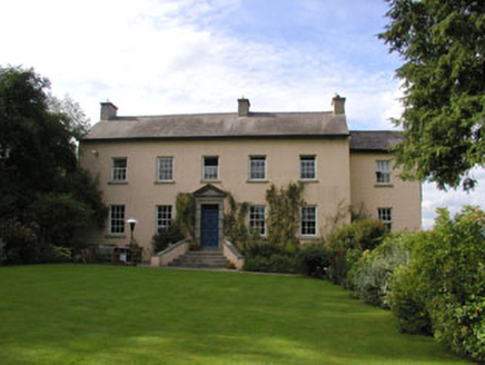 Coolboy HouseHouse · 1.4 mi1798 MemorialMemorial · 1.6 mi(Site of) Raymond CastleCastle, unclassified · 2.5 mi
 Annagh HillMountain / peak · 2.5 mi
 Sessile Oak2.7 mi
 Sweet Chestnut3.1 mi
 Monalee HillMountain / peak · 3.9 mi1798 Lacey Brothers MemorialMemorial · 4.1 miCastleCastle, motte · 4.8 mi
More historic places in County Wicklow · All of County Wicklow

What do you know about this place?Tap to add a comment or ask a question