What is recorded here
From the National Monuments Service (Archaeological Survey of Ireland) record CO041-061
Places near here
Photo credits
- National Inventory of Architectural Heritage
- kevin higgins, Wikimedia Commons · CC BY-SA 2.0
- Tim Sheerman-Chase, Wikimedia Commons · CC BY 2.0
- Mike Searle, Wikimedia Commons · CC BY-SA 2.0
- Mike Searle, Geograph · CC BY-SA 2.0
- Jonathan Thacker, Geograph · CC BY-SA 2.0
- Sitomon, Wikimedia Commons · CC BY-SA 2.0
- The Speckled Bird, Wikimedia Commons · CC BY-SA 4.0
 Aldworth LodgeHouse · 1014 yd
Explorer Tom Aldworth Lodge in Aldworth dates from 1840 and has a Tudor Revival breakfront. It keeps its timber sash windows and carved bargeboards, which give it a solid, interesting look that stands out from the rest of the area.
 Kilcolman LodgeHouse · 1519 yd
Explorer Tom Kilcolman Lodge is a modest gentleman’s house from 1810 that’s still keeping its timber sash windows secret. The render surrounds on the windows are doing a lot of heavy lifting here. It’s got solid gate piers, so check those out!
 St Abigails WellHoly well · 1.9 mi
Explorer Tom St Abigails Well is enclosed in a D-shaped structure with niches for cups, looking very organized and bureaucratic. It’s still in use and has crosses carved on the stones by pilgrims who needed to mark their spot. Stand there long enough and someone will ask if you're lost.
 Fairy fort / earthen ringfort in Carrigcleena MoreFairy fort / earthen ringfort · 2.1 mi
Explorer Tom Fairy fort / earthen ringfort in Carrigcleena More has two banks and a ditch between them, which is quite fancy for a fairy home. The inner bank has a break leading into the fosse. Be careful where you step!
 Dromaneen CastleHeritage attraction · 2.8 mi
 Dromaneen Castle (in Ruins)House, fortified house · 2.8 mi
Explorer Tom Dromaneen Castle sits atop a cliff edge overlooking the Blackwater River. It was an O'Callaghan fortified house built on an earlier castle site. The MacDonagh MacCarthys were the overlords, which sounds like a very dramatic family reunion gone wrong.
 Castle Barrett (in Ruins)Castle, Anglo-Norman masonry castle · 4.0 mi
Explorer Tom Castle Barrett in Castlebarrett is just fragments of walls and a collapsed tower now. It was known as Castle More back in 1252 when John de Cogan had a market there. I wonder if anyone sells pies here anymore!
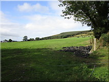 Mount HillaryMountain / peak · 4.7 mi
 Eagle's NestMountain / peak · 5.0 mi
 Mount Hillary - Father Murphy LoopWalking route · 5.6 mi
 European Yew7.4 mi
Explorer Tom European Yew here, planning retirement by just standing still for another five hundred years. It says it's saving up leaves for a big trip to the afterlife. Stick around for the light changing, it's a slow burn show.
 Kanturk CastleHeritage attraction · 8.9 mi
More archaeology and monuments in County Cork · All of County Cork

What do you know about this place?Tap to add a comment or ask a question