
Places near here
Photo credits
- National Inventory of Architectural Heritage
- Kenneth Allen, Geograph · CC BY-SA 2.0
- Kenneth Allen, Wikimedia Commons · CC BY-SA 2.0
- Tawg, Wikimedia Commons · CC BY-SA 3.0
- Eric Jones, Geograph · CC BY-SA 2.0
 Cathaleen's Fall Hydroelectric Power StationHydroelectric power station · 985 yd
Explorer Tom Cathaleen's Fall Hydroelectric Power Station swallowed the famous Assaroe Falls to make a lake. I bet the water is still trying to find its old path under the dam, making weird gurgling noises at night like it’s asking for a refund.
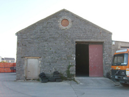 Ballyshannon Railway StationStore/warehouse, goods shed · 1283 yd
Explorer Tom Ballyshannon Railway Station is actually a former goods shed that’s seen better days but still holds its shape well. It gives you a real idea of how much cargo moved around Ireland in the late 1800s. Look for those round openings, they’re quite the feature!
 Melly’s BarPub · 1.1 mi
Explorer Tom Melly’s Bar is parked right on East Port in Ballyshannon, so the fishing stories must be genuinely fresh off the boat. Ask someone if the fish is actually better than the chips served alongside it.
 Standing stone in Townparks (ballyshannon Ed)Standing stone · 1.1 mi
Explorer Tom Standing stone in Townparks is roughly 1.3m high and set on rock outcrop, possibly just a natural feature rather than a true standing stone. Locals say it marks a fording place of the river Erne, but with 'cat's paw' markings that might be natural too, it’s hard to know if it’s a guide or just a grumpy rock.
 Rory GallagherMemorial · 1.2 mi
Explorer Tom Rory Gallagher memorial? That's just a guy who played guitar, right? Well, sort of. Go back in winter, it's a different animal when the wind is howling and you're pretending you know what you're doing.
 Kate's KitchenCafé · 1.2 mi
Explorer Tom Kate's Kitchen sounds like the place where home cooking meets commercial ambition, likely serving up something that tastes better than your mum makes it. Find out what dish Kate is most proud of preparing for customers.
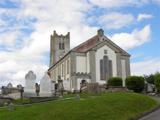 St Anne's Church GraveyardGraveyard · 1.3 mi
Explorer Tom St Anne's Church Graveyard is where the real history of Ballyshannon sleeps, next to a church that moved in 1691 and got new bones in 1841. It’s serious business with a side of tradition. Great spot to propose. Or at least to propose lunch, keep it light.
 Dungravenen Promontory FortPromontory fort, coastal · 1.6 mi
Explorer Tom Dungravenen Promontory Fort is a spectacular coastal spot where you can crawl through rock-cut chambers under the soil. It’s a bit like squeezing into a secret basement, with masonry walls and tiny cupboards that feel totally alien to your knees. Just remember the flagstones are doing all the heavy lifting up there.
 Battlefield in Cloghore (carrickboy Ed),corlea (pettigo Ed)Battlefield · 2.6 mi
Explorer Tom Battlefield in Cloghore, Corlea is a spot where two armies argued so loud the trees moved to avoid the noise. It's basically a giant historical tantrum waiting for your attention. Snap one photo, then put the phone away and actually look at what you've found.
 Battle of BelleekBattle · 2.9 mi
Explorer Tom Battle of Belleek, also called the Battle of the Erne Fords, took place at a River Erne crossing near Belleek on 10 October 1593. Hugh Maguire's defenders faced Henry Bagenal's English Crown force. I want to point at the exact ford, but that would be Tom bluffing: this marker shows the general area, and no battlefield boundary has been surveyed.
 Belleek Pottery MuseumMuseum · 3.0 mi
 Belleek PotteryHeritage attraction · 3.1 mi
More archaeology and monuments in County Donegal · All of County Donegal

What do you know about this place?Tap to add a comment or ask a question