
Places near here
Photo credits
- National Inventory of Architectural Heritage
- Kmcnamee, Wikimedia Commons · CC BY-SA 4.0
- Sheila1988 / Wikimedia Commons, commons.wikimedia.org
- Niallio77, Wikimedia Commons · CC BY-SA 3.0
- Maelor at English Wikipedia, Wikimedia Commons · Public domain
- Maker not stated on source page, en.wikipedia.org
- Zxcode / Wikimedia Commons, commons.wikimedia.org
- Andreas F. Borchert, Wikimedia Commons · CC BY-SA 4.0
- Oliver Dixon, Geograph · CC BY-SA 2.0
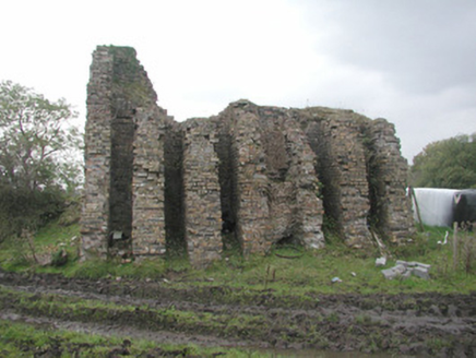 Coolaney Brick WorksKiln · 1.7 mi
Explorer Tom Coolaney Brick Works would be absolute gold on a reality show, mostly because it’s slowly collapsing into the earth…
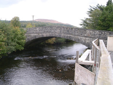 bridge2.0 mi
Explorer Tom Bridge in Coolaney has made its New Year's resolution to stop cars from driving over it like it’s a speed bump. It’s an…
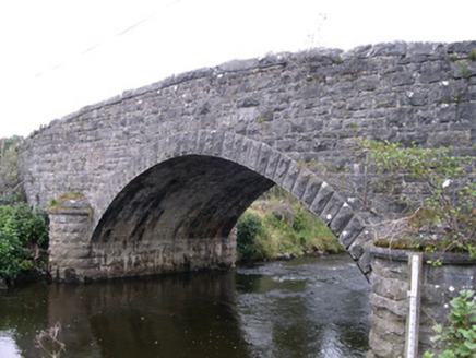 Billa BridgeBridge · 2.2 mi
Explorer Tom Billa Bridge over the Owenbeg is an imposing feature that even Vikings missed on their way south. The stone plaques are…
 Ballisodare GAAGAA ground · 2.9 mi
 Ransboro Park, Coolera/StrandhillGAA ground · 3.5 mi
 CulleenamoreBeach / strand · 3.8 mi
Explorer Tom Culleenamore Strand hides behind Strandhill's Atlantic swagger, facing into Ballysadare Bay where the sandbanks and sky…
 Miosgan MevaPassage tomb · 3.9 mi
Explorer Tom Miosgan Meva is the big brother on Knocknarea, sitting there like a giant stone bread loaf that nobody wants to eat.…
Queen Medb's Cairn: KnocknareaLegend location · 4.0 miExplorer Tom Queen Medb's Cairn: Knocknarea sits high on the mountain, and legend gives it a queen for an occupant. It is an…
 Seamie Donegan Memorial Park, St. Patrick's GAA, Skreen/DromardGAA ground · 4.4 mi
 Owenmore Gaels GAA pitchGAA ground · 4.5 mi
 The Cailleach: CarrowmoreLegend location · 4.6 mi
Explorer Tom The Cailleach: Carrowmore is a field of ancient tombs with a woman in the stories powerful enough to shape the land…
 Strandhill BeachBeach / strand · 4.7 mi
Explorer Tom Strandhill Beach is where Sligo gives the Atlantic a front row seat and the Atlantic responds by showing off. Look up…
More archaeology and monuments in County Sligo · All of County Sligo

What do you know about this place?Tap to add a comment or ask a question