What is recorded here
From the National Monuments Service (Archaeological Survey of Ireland) record ME009-011001
Places near here
Photo credits
- Kieran Campbell, Geograph · CC BY-SA 2.0
- National Inventory of Architectural Heritage
- Malene Thyssen, Wikimedia Commons · CC BY-SA 3.0
- John M, Wikimedia Commons · CC BY-SA 2.0
- Mike Searle, Geograph · CC BY-SA 2.0
- Mike Searle, Wikimedia Commons · CC BY-SA 2.0
- Sitomon, Wikimedia Commons · CC BY-SA 2.0
- Kieran Campbell, Wikimedia Commons · CC BY-SA 2.0
- James Fergusson, after E. Conwell, Wikimedia Commons · Public domain
- Bill Griffiths, Wikimedia Commons · CC BY-SA 2.0
- Richard Webb, Geograph · CC BY-SA 2.0
 CastleCastle, motte and bailey · 1199 yd
Explorer Tom Castle in Castlecor started as a bet between two lads in the pub about who could build the biggest dirt pile. They won, then forgot to mention it had trees growing out of it. Tell the kids it's a castle. Close enough.
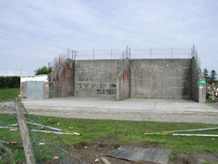 Saint Oliver Post Primary SchoolHandball alley · 1.1 mi
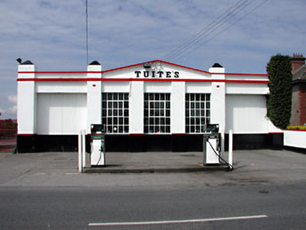 Tuite'sWorkshop · 1.2 mi
Explorer Tom Tuite's garage would tell its younger self to stop worrying about the steel windows; they’re iconic now. It’s sleek, simple, and looks like it knows exactly where it fits. Take the long way round to admire the doors.
 European Beech1.8 mi
Explorer Tom European Beech in County Meath would have made Saint Patrick pause his sermon to check if it was listening properly. It’s got that smooth, elegant bark that makes everything else look messy. Best enjoyed with a bag of chips and no plans.
 LoughcrewMegalithic tomb cemetery · 3.6 mi
 MoatCastle, motte · 3.6 mi
 Loughcrew GardensGarden · 3.6 mi
 European Yew3.6 mi
Explorer Tom European Yew in County Meath witnessed a love story that went horribly wrong right next to its trunk. The poor tree is still flinching from the drama. It's free, it's odd, what more do you want?
 Cairn SArchaeological place · 3.9 mi
 Hag's ChairArchaeological place · 3.9 mi
 Slieve Na CalliaghMountain / peak · 4.0 mi
 IslandMountain / peak · 4.5 mi
Explorer Tom Island is a peak in County Cavan where the silage is safely in, despite the rain noted in its saved picture caption.
More archaeology and monuments in County Meath · All of County Meath

What do you know about this place?Tap to add a comment or ask a question