
What is recorded here
From the National Monuments Service (Archaeological Survey of Ireland) record GA122-049001
Places near here
Photo credits
- National Inventory of Architectural Heritage
- Dr Charles Nelson, Wikimedia Commons · CC BY-SA 2.0
- Lucarelli, Wikimedia Commons · CC BY-SA 3.0
- dougf, Wikimedia Commons · CC BY-SA 2.0
- John M, Geograph · CC BY-SA 2.0
- Humphrey Bolton, Geograph · CC BY-SA 2.0
- Andreas F. Borchert, Wikimedia Commons · CC BY-SA 4.0
- Dr Charles Nelson, Geograph · CC BY-SA 2.0
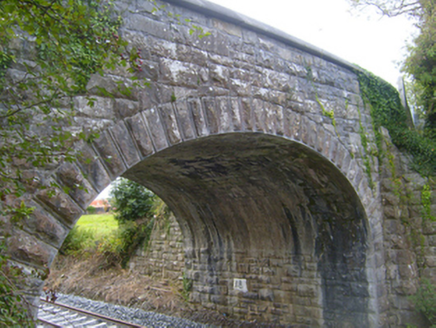 bridge310 yd
Explorer Tom Bridge in Cloonnahaha has strong opinions on modern architecture, mostly that it looks like a sneeze. Its arch is so proud it could stand alone. Have a sandwich and admire its stubborn stone face from afar.
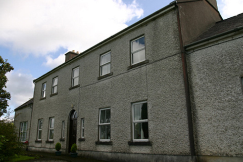 Prospect HouseCountry house · 1165 ydCastle IslandIsland · 1.8 mi
 Newtown Castle (in ruins)Castle, tower house · 1.8 mi
Explorer Tom Newtown Castle in Castlequarter is round and proud of it, sitting in land that floods when it feels like it. It would use its lotto win to buy better boots for its owner. Tell the next person you meet it's haunted; it might be, or it might just be a damp echo.
Swan IslandIsland · 2.3 mi Holm Oak2.6 mi
 Kiltartan Castle (in ruins)Castle, Anglo-Norman masonry castle · 2.7 mi
Explorer Tom Kiltartan Castle in Castletown holds a fake world record for being the most stubborn ruin on a riverbank. It’s been there since the de Burgo days, looking grumpy. It's free, it's odd, what more do you want? Just don't ask it to smile, it might cost you a coin.
 Kilmacduagh Monastic SiteVisitor information · 2.7 mi
 Kilmacduagh MonasteryHeritage attraction · 2.7 mi
 Templemore or Cathedral (in ruins)Cathedral · 2.8 mi
Explorer Tom Templemore or Cathedral in Kilmacduagh is older than your excuses and twice as stubborn. It kept its independence when everyone else caved. Ten minutes here and you'll have a yarn for the pub.
 Coole ParkWood · 2.8 mi
 Grave YardGraveyard · 2.8 mi
More archaeology and monuments in County Galway · All of County Galway

What do you know about this place?Tap to add a comment or ask a question