
What is recorded here
In an earthwork (MA091-001001-). This stone-built Man-made underground passage is indicated on the 1920 edition as ‘Cave’. It is exposed at surface level on the broadly sloping W slope of the earthwork/mound. The W terminal of the passage is located at the base of the mound, and from there the passage zig-zags upslope…
Read the whole record
From the National Monuments Service (Archaeological Survey of Ireland) record MA091-001002
Places near here
Photo credits
- National Inventory of Architectural Heritage
- Michael Deligan, Wikimedia Commons · CC BY-SA 4.0
- JohnArmagh, Wikimedia Commons · CC BY-SA 3.0
- Mike Searle, Wikimedia Commons · CC BY-SA 2.0
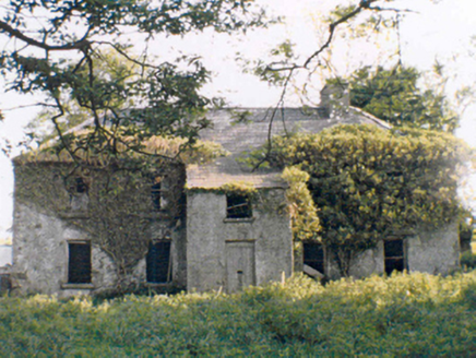 RockstownFarm house · 1.1 mi
Explorer Tom Rockstown is currently stuck in a massive legal dispute with the local fairies over who gets parking rights in front. They’ve been arguing about it since before the roof started sagging into the dirt. Bring the dog, it’ll probably side with the fairies.
IndicatedFairy fort / earthen ringfort · 1.1 mi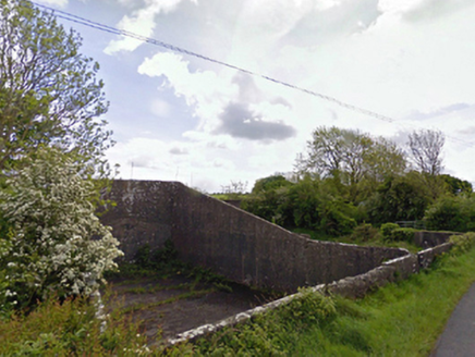 handball alley1.5 mi
Explorer Tom This handball alley in Rathduff thinks the road leading to it is too slow and lazy. It’s dilapidated but still remembers when it hosted the best rallies in County Mayo. Go now, before it gets a complex about its cracks.
 bridge1.6 mi
Explorer Tom Bridge in Rathduff [clan. by. Balla Ph.] hosted a dance that went so far they danced on top of it. The locals still claim the stones are slippery because of all those fancy shoes! Make up your own legend about why it’s there; I think it was built to trap fairies, but who knows for sure?
 Saint Cronan's Catholic ChurchChurch/chapel · 1.6 mi
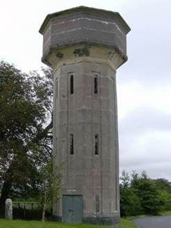 water tower1.6 mi
Explorer Tom Balla’s water tower would tell you in a job interview that it has excellent retention skills. It’s just standing there looking smug while everyone else rushes around below. Ring your granny and ask her to verify its height for you.
 Round Tower1.6 mi
Explorer Tom Round Tower in Balla is standing there with no roof, looking utterly confused about the weather situation. There’s a curse that only affects people who don't wave at it. Bring a jacket, it's never as warm as I promise.
CastleCastle, ringwork · 2.2 miExplorer Tom The local sheep have strong opinions about this ringwork in Brees, mostly that it blocks their path to better grazing spots. They look at you like you’re trespassing on their very private spa day. Go at sunset and thank me later for the drama.
Carrowbeg WoodWood · 2.7 miI'll Send You The FareMemorial · 4.8 miKiltimagh MuseumMuseum · 4.9 mi Doonamona CastleCastle · 5.2 mi
More archaeology and monuments in County Mayo · All of County Mayo

What do you know about this place?Tap to add a comment or ask a question