What is recorded here
Places near here
Photo credits
- Mike Searle, Geograph · CC BY-SA 2.0
- National Inventory of Architectural Heritage
- Mike Searle, Wikimedia Commons · CC BY-SA 2.0
- Sitomon, Wikimedia Commons · CC BY-SA 2.0
- Jonathan Thacker, Geograph · CC BY-SA 2.0
- The Speckled Bird, Wikimedia Commons · CC BY-SA 4.0
- kevin higgins, Wikimedia Commons · CC BY-SA 2.0
Explorer Tom An underground passage in Cloonteens has no visible trace, so it’s just a rumor living in a levelled ringfort. I bet a poet fell into the ditch nearby and wrote a very angry sonnet about it. Stick around for the light changing, it's a show.
 Castle Magner (in Ruins)Bawn · 1346 yd
Explorer Tom Castle Magner Bawn in Castlemagner, County Cork was forfeited by the Magners and then given back to them, which sounds like a very confusing game of tag. Now it’s just a farmyard with some historical vibes. Try not to let the Bretridges steal your story while you’re there!
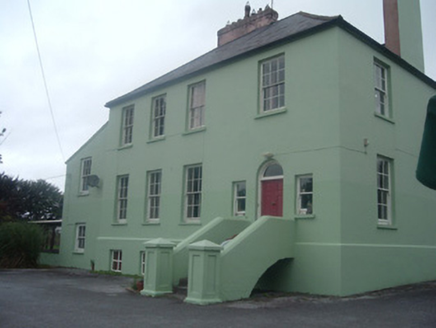 The Old RectoryRectory/glebe/vicarage/curate's house · 1377 yd
Explorer Tom The Old Rectory has its door at the end of the facade, which is very odd. It’s like the vicar didn’t want to meet anyone. Imagine the dance party that happened there and got out of hand.
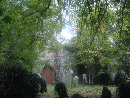 Saint Bridget's Church (Castlemagner)Church/chapel · 1378 yd
Explorer Tom Saint Bridget's Church in Castlemagner is sitting quiet with its brass bell still hanging there. It’s got marble floor tiles inside that probably saw better days. Take a breath and appreciate the stone hood-mouldings.
 Lohort CastleCastle, tower house · 1.5 mi
Explorer Tom Lohort Castle in Castlelohort Demesne, County Cork was burnt down in 1922 but now it’s a private residence with a stepped gable. It’s five storeys high and looks very pleased with itself. Knock on the door if you want to see if anyone is home!
 European Yew1.5 mi
Explorer Tom European Yew here, planning retirement by just standing still for another five hundred years. It says it's saving up leaves for a big trip to the afterlife. Stick around for the light changing, it's a slow burn show.
Graveyard in Ballygiblin (duhallow By.)Graveyard · 1.6 miExplorer Tom Graveyard in Ballygiblin got bulldozed for quarrying, which is basically nature’s way of saying 'move along'. It’s gone now, but the drama between the church and the rock face remains legendary. Perfect place to be dramatically windswept.
 Mount Hillary - Father Murphy LoopWalking route · 3.3 mi
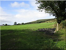 Mount HillaryMountain / peak · 3.3 mi
 Kanturk CastleHeritage attraction · 3.7 mi
 Dromaneen CastleHeritage attraction · 4.1 mi
 St Abigails WellHoly well · 4.3 mi
Explorer Tom St Abigails Well is enclosed in a D-shaped structure with niches for cups, looking very organized and bureaucratic. It’s still in use and has crosses carved on the stones by pilgrims who needed to mark their spot. Stand there long enough and someone will ask if you're lost.
More woods, forests and old trees in County Cork · All of County Cork

What do you know about this place?Tap to add a comment or ask a question