DDiscover AloneMapAbout

Castlecomer

Historic town

The monument record does not grant public access. Check the route and ask the landowner before entering private land.

What survives
Recorded monument
What do you know about this place?Tap to add a comment or ask a question

What you write will be public.

What is recorded here

The town is orientated E-W, with houses running N and S from the main street (Bridge/High Street) which widens towards the W end and narrows towards the bridge at the E end which crosses the Dinin river (also known as the river Deen). The river Cloghogue, a tributary of the Dinin, runs E-W N of the town. The S end of…

Read the whole record
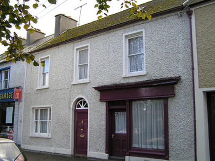
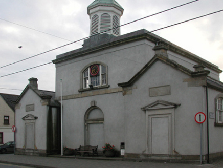
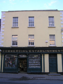
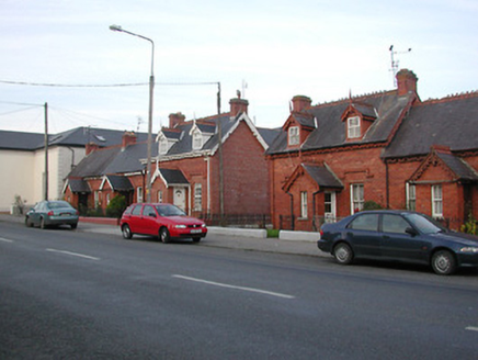
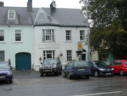
The town is orientated E-W, with houses running N and S from the main street (Bridge/High Street) which widens towards the W end and narrows towards the bridge at the E end which crosses the Dinin river (also known as the river Deen). The river Cloghogue, a tributary of the Dinin, runs E-W N of the town. The S end of High Street forms a crossroads with Chatworth Row running off to the N, Kilkenny Street running off to the S and Barrack Street running to the W. It is likely that there was a medieval settlement in Castlecomer associated with a late 12th/early 13th-century castle and motte (KK005-033001-/ KK005-033002-). The motte is located c. 130m NE of the bridge, in the grounds of Castlecomer House (KK005-081----) which was built in 1638. A tributary of the Dinin river, the Brokagh, flows roughly E-W between the castle and Castlecomer House. The medieval church (KK005-034----), though no longer surviving above ground, is possibly located on or near the site of St Mary's church, c. 150m NE of the motte. By the mid-14th century Castlecomer appears to have been reclaimed by the O’Brenans as part of their territory of Odogh (Idough) (Ó Drisceoil 2018, 49). However, the strategic location of Castlecomer between Dublin and Kilkenny, combined with its rich natural resources of coal, iron and timber, made it an attractive acquisition and this was achieved in 1635 by Thomas Wentworth, the Lord Deputy of Ireland who confiscated Idough on behalf of the crown (ibid. 51-2). In the process many Catholic families loyal to the crown were displaced, including Richard, Viscount Mountgarret and Richard Butler of Castlecomer (ibid. 52). In 1637 Wentworth sold Idough to Christopher Wandesforde, an acquisition which was given royal approval two years later when it was granted to him by Charles I as the ‘manor of Castlecomer’ (ibid. 52-3). This grant also gave Wandesforde the right to hold weekly markets and three fairs annually in his new plantation town (ibid. 53). Carrigan (1905, vol. 2, 158-9) quotes from Thomas Comber’s 1778 biography of Wandesforde, that, ‘he built near the old Castle an elegant Town, exactly on the model of a famous one in Italy, viz., Alsinore. The houses were all of free stone very convenient, with a noble Market Place in the Centre…He erected…a forge…[and] from the ground, a very handsome church…a stately house for the minister…a good inn, and erected “on Colliery Hill a pretty convenient castle to protect his steward and colleries from the wild Irish”’. During the 1641 Rising the English Protestant planters, 500 of which had been brought over to occupy Wandesforde’s estate and town, took refuge in the new church, the ‘old castle on “the Garrison” and in a house belonging to an Englishman named Parkinson (Carrigan 1905, vol. 2, 159; Ó Drisceoil 2018, 53). The church and house, the latter burnt, were taken fairly quickly by the Catholic Confederate forces, led by Captain John Bryan and Captain Phillip Purcell, and finally the castle, which held out for more than three months, was surrendered in March 1642 (Carrigan 1905, vol. 2, 159). Immediately following this Richard Butler was directed by Mountgarret to take of over the ‘Castle & fort’ of Castlecomer from their fellow rebels (Ó Drisceoil 2018, 55). The ‘fort’ possibly refers to the bastioned fort (KK005-104----) located at the NE end of town, between the Dinin river and its tributary, the Cloghogue (Ó Drisceoil 2018, 46-77). During the 1798 rebellion the United Irishmen fought the Crown Forces in the ‘Battle of Comer’, as a result of which the town and the original Wandesforde residence, Castlecomer House, was burnt (ibid. 58). Following this a major rebuilding campaign of the town and Castlecomer House was instigated by Anne Countess of Ormond and Ossory, as quoted by Carrigan from Mason’s (1802) Statistical Survey, ‘Castlecomer has 211 houses; many of them good and slated; part of this town was burnt during the late rebellion, and has been rebuilt in a handsome manner; the principal part of the town is one very broad street, well-built’ (Carrigan 1905, vol. 2, 159; Ó Drisceoil 2018, 58).

From the National Monuments Service (Archaeological Survey of Ireland) record KK005-082

Places near here

Picture notes
  • National Inventory of Architectural Heritage
  • A.-K. D., Wikimedia Commons · CC0
  • Computer-made picture. It does not show this playground.
  • Sitomon, Wikimedia Commons · CC BY-SA 2.0
  • A.-K. D., Wikimedia Commons · CC BY-SA 4.0
  • Malene Thyssen, Wikimedia Commons · CC BY-SA 3.0
Orton HouseHouse · 24 yd

Explorer Tom Orton House has caught my eye in Castlecomer, County Kilkenny. I bet a house with a name like that could keep me talking all afternoon; I'm already inventing a daft little scene for it, and I'll stop before it turns into history.

Bank of IrelandHouse · 33 yd

Explorer Tom Bank of Ireland has caught my eye in Castlecomer, County Kilkenny. I bet a house with a name like that could keep me talking all afternoon; I'm already inventing a daft little scene for it, and I'll stop before it turns into history.

1798Memorial · 173 yd

Explorer Tom Memorial has caught my eye in County Kilkenny. I bet a memorial with a name like that could keep me talking all afternoon; I'm already inventing a daft little scene for it, and I'll stop before it turns into history.

Battlefield in Castlecomer,drumgoole,glebe (fassadinin By.),kiltown (fassadinin By.)Battlefield · 242 yd

Explorer Tom Battlefield in Castlecomer, Drumgoole, Glebe, Kiltown has caught my eye in Castlecomer, Drumgoole, Glebe, Kiltown, County Kilkenny. I bet a battlefield with a name like that could keep me talking all afternoon; I'm already inventing a daft little scene for it, and I'll stop before it turns into history.

Children's playground344 ydComputer-made picture. It does not show this playground.

Explorer Tom Children's playground has caught my eye in County Kilkenny. I bet a children's playground with a name like that could keep me talking all afternoon; I'm already inventing a daft little scene for it, and I'll stop before it turns into history.

European Yew377 yd

Explorer Tom European Yew has caught my eye in County Kilkenny. I bet a european yew with a name like that could keep me talking all afternoon; I'm already inventing a daft little scene for it, and I'll stop before it turns into history.

The GarrisonCastle, motte · 405 yd

Explorer Tom The Garrison has caught my eye in Ardra, County Kilkenny. I bet a castle, motte with a name like that could keep me talking all afternoon; I'm already inventing a daft little scene for it, and I'll stop before it turns into history.

Estate YardMemorial · 483 yd

Explorer Tom Estate Yard has caught my eye in County Kilkenny. I bet a memorial with a name like that could keep me talking all afternoon; I'm already inventing a daft little scene for it, and I'll stop before it turns into history.

Holy Well636 yd

Explorer Tom Holy Well in Drumgoole has caught my eye in Drumgoole, County Kilkenny. I bet a holy well with a name like that could keep me talking all afternoon; I'm already inventing a daft little scene for it, and I'll stop before it turns into history.

Elf VillageChildren's playground · 890 ydComputer-made picture. It does not show this playground.

Explorer Tom Elf Village has caught my eye in County Kilkenny. I bet a children's playground with a name like that could keep me talking all afternoon; I'm already inventing a daft little scene for it, and I'll stop before it turns into history.

Ardra LoopWalking route · 1095 yd

Explorer Tom Ardra Loop has caught my eye in County Kilkenny. I bet a walking route with a name like that could keep me talking all afternoon; I'm already inventing a daft little scene for it, and I'll stop before it turns into history.

European Beech1130 yd

Explorer Tom European Beech has caught my eye in County Kilkenny. I bet a european beech with a name like that could keep me talking all afternoon; I'm already inventing a daft little scene for it, and I'll stop before it turns into history.

More archaeology and monuments in County Kilkenny · All of County Kilkenny

Add to this placeAdd a picture Add a detailed tip Add a story

Explore the map1,118,976 places to discover

Next place · or swipeOrton House