DDiscover AloneMapAbout

Bastioned fort in Castlecomer

Bastioned fort
Computer-made picture that does not show Bastioned fort in CastlecomerNot a photo of this monument
Computer-made picture. It does not show this monument. · Report the wrong picture

The monument record does not grant public access. Check the route and ask the landowner before entering private land.

What do you know about this place?Tap to add a comment or ask a question

What you write will be public.

What is recorded here

On a low prominence in a triangle of land formed by the river Dinin (also known as the river Deen) flowing N-S to the E and its tributary the river Cloghogue, flowing E-W to the N. At the NE end of Castlecomer town, where the Avalon House hotel is currently located and c. 120m NW of the bridge over the Dinin. During…

Read the whole record
On a low prominence in a triangle of land formed by the river Dinin (also known as the river Deen) flowing N-S to the E and its tributary the river Cloghogue, flowing E-W to the N. At the NE end of Castlecomer town, where the Avalon House hotel is currently located and c. 120m NW of the bridge over the Dinin. During the 1641 Rising c. 400 English Protestant planters, which had been brought over to occupy the Wandesforde estate and Castlecomer town, took refuge in the ‘old castle on “the Garrison”’ (Carrigan 1905, vol. 2, 159; Ó Drisceoil 2018, 53). The castle, which held out for more than three months, was surrendered in March 1642 to the Catholic Confederate forces, led by Captain John Bryan and Captain Phillip Purcell (Carrigan 1905, vol. 2, 159). Immediately following this Richard Butler was directed by Mountgarret to take of over the ‘Castle & fort’ of Castlecomer from their fellow rebels, the ‘fort’ possibly refers to the bastioned fort (Ó Drisceoil 2018, 55). A petition of 1653 from William Wandesforde to the Commonwealth government relates how Wandesforde and his family had been forced to flee their house and estate in Castlecomer when the Rising broke out and could only return after the estate had been secured by the English Parliamentary forces, thanks to ‘an English garrison placed there’ (ibid. 57). The garrison fort is not mentioned in historical sources relating to the Williamite Wars or to the later 1798 rebellion when the United Irishmen fought the Crown Forces in the ‘Battle of Comer’ and the town and original Wandesforde residence were burnt (ibid. 58). The fact that the bastioned fort is not mentioned in the detailed records of the later battle, which took place in and around the streets of Castlecomer, suggests that it no longer functioned as a military fort by this date (ibid.). A roughly square or rectangular fort enclosed by a battered wall of roughly coursed limestone rubble with a rubble core (T 1.6m) with pointed bastions/flankers (NE max. ext. dims. 21.4m x 21m) projecting from each corner and an external moat (Wth 10.8m; D ˃ 0.8m) (ibid. 62, 73-4). The flankers were perpendicular to the curtain wall, forming a right-angled re-entrant and the two faces formed a salient angle of 70 degrees (ibid. 62). The moat may originally have been wet, perhaps fed via a leat from the Cloghogue tributary (ibid. 74). The 1812, ‘Plan of the Town of Castlecomer’ by James Healy shows much of the N and E portion of the bastioned fort surviving, including the N and E walls, as well as the NE and SE corner bastions and part of the NW corner bastion (ibid. 56 fig. 7, 58). The fort occupied a large portion of the NE side of the town, fronting onto the main street (Bridge/High Street), though by the early 19th century house plots had begun to encroach on the W side and within the moat on the E side (ibid. 58-9). By the 1st (1839) ed. OS 6-inch map all but a possible fragment of the NW bastion and a short stretch of the S side of the E wall had been removed (ibid. 59). It is possible that an angular wall at the rear of a coal-yard on the N side of High Street may form part of the NW corner bastion, but heavy ivy-cover has obscured the nature of the walling (ibid. 71). An archaeological excavation (Excavation No. 16E0183) by Cóilín Ó Drisceoil in 2018 revealed the NE portion (N L 10.8m of the total estimated L of 18.9m; E L 18.9m) of the NE corner bastion and portion (L 6.5m) of the S bastion flank (ibid. 63, fig. 12, 65). Based on the available evidence Ó Drisceoil (2018, 71) estimates that this was a square bastioned fort (ext. dims. including moat 120m x 120m; int. main square 65m x 65m), overall occupying 3.5 acres.

From the National Monuments Service (Archaeological Survey of Ireland) record KK005-104

Places near here

Photo credits
  • National Inventory of Architectural Heritage
  • A.-K. D., Wikimedia Commons · CC0
  • A.-K. D., Wikimedia Commons
  • A.-K. D., Wikimedia Commons · CC BY-SA 4.0
  • Maker not stated on source page, commons.wikimedia.org
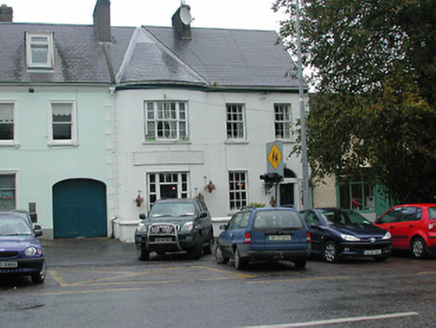
Orton HouseHouse · 74 yd

Explorer Tom Orton House in Castlecomer thinks it’s got a secret twin hiding across the Atlantic Ocean. That bowed end bay is its…

Bank of IrelandHouse · 84 yd

Explorer Tom The Bank of Ireland in Castlecomer is feuding with the next village over because they said their columns are wider than…
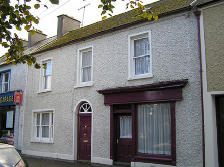
McKennaHouse · 121 yd

Explorer Tom McKenna was built on a bargain where the builder paid for bricks with gossip. It has a window that looks like it’s…

Clohogue HouseHouse · 189 yd

Explorer Tom Clohogue House in Castlecomer is dressing up for a wedding it wasn’t invited to, wearing way too much solid wall and…

worker's house239 yd

Explorer Tom Worker's house in Ardra was designed by an Indian bungalow, which explains why it looks so relaxed and slightly out of…

outbuilding245 yd

Explorer Tom Outbuilding in Castlecomer claims to be older than the town, which is a bold move. It looks rustic enough to back that…

vent pipe254 yd

Explorer Tom Vent pipe in Castlecomer would post a selfie of its own fluted parapet every morning and call it ‘good vibes only’ for…

bridge265 yd

Explorer Tom Bridge in Ardra was played on all night by a fiddler who never stopped dancing. The bridge says the music made its…

Castlecomer Discovery ParkHeritage attraction · 389 yd

Explorer Tom Castlecomer Discovery Park manages to put a woodland walk, an old mining story and a burst of adventure in the same…

Estate YardMemorial · 423 yd

Explorer Tom Estate Yard in County Kilkenny used to run a water-powered mill and a metal foundry, which means it’s been busy as a…

Church of the Immaculate Conception GraveyardGraveyard · 549 yd

Explorer Tom Church of the Immaculate Conception Graveyard in Kilkenny is locked in an ancient feud with the rain, basically…

Holy well in Kiltown (fassadinin By.)Holy well · 1.1 mi

Explorer Tom Holy well in Kiltown was designed by a very strict mother-in-law who demanded everything be perfectly aligned. A man…

More archaeology and monuments in County Kilkenny · All of County Kilkenny

Add to this placeAdd a picture Add a detailed tip Add a story

Explore the map1,095,414 places to discover

Next place · or swipeOrton House