
What is recorded here
From OpenStreetMap (© OpenStreetMap contributors) w194539871
Places near here
Photo credits
- National Inventory of Architectural Heritage
- kevin higgins, Geograph · CC BY-SA 2.0
- Garry Dickinson, Geograph · CC BY-SA 2.0
- Mike Searle, Wikimedia Commons · CC BY-SA 2.0
- David Purchase, Geograph · Creative Commons Attribution-ShareAlike 2.0
- Darrin Antrobus, Wikimedia Commons · CC BY-SA 2.0
- Algirdas at Lithuanian Wikipedia, Wikimedia Commons · Public domain
- Donald Hobern from Copenhagen, Denmark, Wikimedia Commons · CC BY 2.0
- Richard Webb, Geograph · CC BY-SA 2.0
- A.-K. D., Wikimedia Commons · CC BY-SA 4.0
- Humphrey Bolton, Geograph · Creative Commons Attribution-ShareAlike 2.0
 Boro BridgeBridge · 402 yd
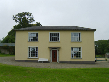 BelmontFarm house · 774 yd
 SlievebaunMountain / peak · 4.8 mi
 Wilton HouseCastle, unclassified · 4.9 mi
 Castle (in ruins)Castle, tower house · 5.5 mi
 Clonmore Grave YardGraveyard · 6.0 mi
 Battle of EnniscorthyBattle · 6.9 mi
 Pedunculate Oak7.2 mi
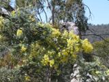 Silver Wattle7.4 mi
Explorer Tom Silver Wattle in County Carlow has strict rules: no screaming, no bad puns, and definitely no touching the bark without asking. It's all about manners out here. Stand there long enough and someone will ask if you're lost or just shy.
 Carrickbyrne HillMountain / peak · 8.0 mi
 St. Mullins WellHoly well · 8.5 mi
Explorer Tom St. Mullins Well is dry as a bone, which is rude for a holy water source. It’s basically a stone cup with no drink, so tell the kids it's a castle. Close enough to make them stop squirming.
 Graveyard in St. Mullin'sGraveyard · 8.5 mi
Explorer Tom Graveyard in St. Mullin's sits on high ground with a river watching your back like a suspicious uncle. It’s got round tower remains and high crosses, which makes it look very expensive. Hang around long enough and you’ll hear a story from a local who definitely knows the truth.
More historic places in County Wexford · All of County Wexford

What do you know about this place?Tap to add a comment or ask a question